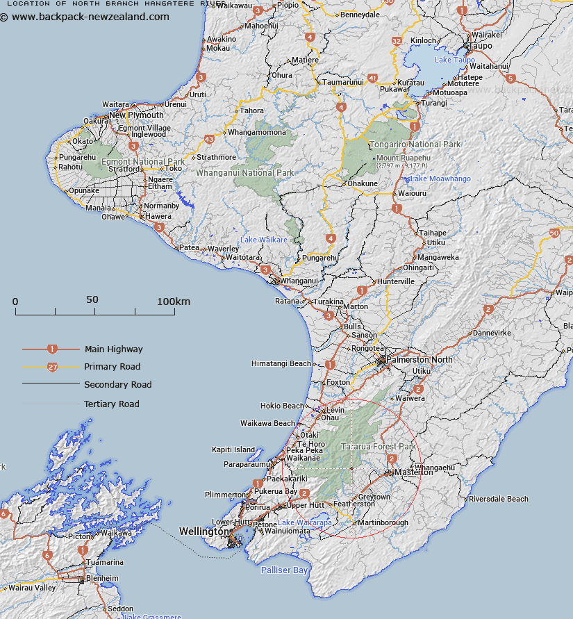
Map showing location of North Branch Mangatere River


LINZ description: Rises west of Carrington Ridge and flows south-east into Mangatarere Creek.
Latitude: -40.925072
Longitude: 175.443491
Northing: 5466685.8
Easting: 1805742.8
Land District: Wellington
Feat Type: Stream


Scroll down to see a more detailed road map and below that a topographical map showing the location of North Branch Mangatere River. The road map has been supplied by openstreetmap and the topographical map of North Branch Mangatere River has been supplied by Land Information New Zealand (LINZ).

Yes you can use the top static map for you school/university project or personal website with a link back. Contact me for any commercial use.

North Branch Mangatere River Map New Zealand


New Zealand places in our database
[ A ] [ B ] [ C ] [ D ] [ E ] [ F ] [ G ] [ H ] [ I ] [ J ] [ K ] [ L ] [ M ] [ N ] [ O ] [ P ] [ Q ] [ R ] [ S ] [ T ] [ U ] [ V ] [ W ] [ X ] [ Y ] [ Z ]


Closest 20 Streams to North Branch Mangatere River

Gentle Annie Creek ( 2.5km )   Totara Creek ( 2.63km )   Kiddie Creek ( 2.88km )   Red Rock Creek ( 3.5km )   Sayer Creek ( 4.43km )   Kaipaitangata Stream ( 4.91km )   Holdsworth Creek ( 5.15km )   Isabelle Creek ( 5.73km )   Deep Creek ( 5.92km )   Atiwhakatu Stream ( 6.09km )   Enaki Stream ( 6.73km )   Fall Stream ( 7.02km )   Rocky Stream ( 7.12km )   Makaka Creek ( 7.27km )   Makaka Creek (Long Flat Creek) ( 7.42km )   Maungahuka Stream ( 7.63km )   Mangahuka Stream ( 7.63km )   Muir Creek ( 7.71km )   Neill Creek ( 8.36km )   Fern Stream ( 8.39km )   Clem Creek ( 8.69km )   Bed Creek ( 8.69km )   Clem Stream ( 8.78km )   Roaring Stream ( 8.78km )   Blake Stream ( 9.02km )   Devil Creek ( 9.31km )   Francis Creek ( 9.43km )   Black Creek ( 9.64km )   Tarahanga Stream ( 10.03km )   Hector River ( 10.18km )   Josephson Creek ( 10.27km )   Baldy Creek ( 10.39km )   Stoney Creek ( 10.51km )   Aokaparangi Creek ( 10.93km )   Coal Stream ( 11.02km )   Whatiuru Creek ( 11.05km )   Sunny Stream ( 11.47km )   Mangatarere Stream ( 11.69km )   Angle Knob Creek ( 11.73km )   Corkill Stream ( 11.75km )