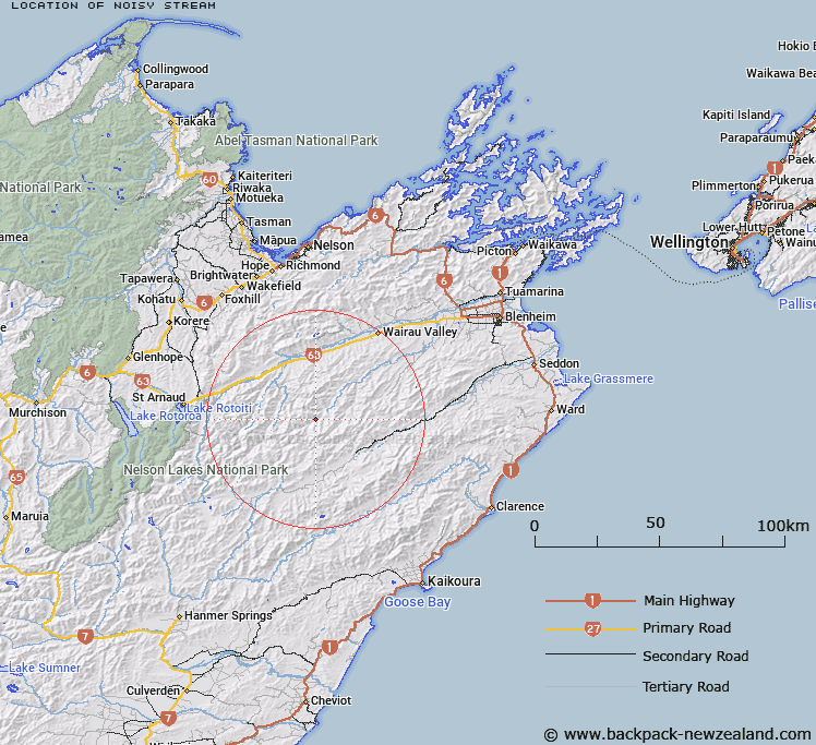
Map showing location of Noisy Stream


LINZ description: Left bank tributary of Waihopai River rising 3.5km South-east of Pinnacle Peak, flowing South-eastward and joining Waihopai River 2.7km upstream from Glazebrook Stream. Blocks XIII, Spray Survey District and XVI, Leatham Survey District.
Latitude: -41.854807
Longitude: 173.311285
Northing: 5366297.3
Easting: 1625838.4
Land District: Marlborough
Feat Type: Stream


Scroll down to see a more detailed road map and below that a topographical map showing the location of Noisy Stream. The road map has been supplied by openstreetmap and the topographical map of Noisy Stream has been supplied by Land Information New Zealand (LINZ).

Yes you can use the top static map for you school/university project or personal website with a link back. Contact me for any commercial use.

Noisy Stream Map New Zealand


New Zealand places in our database
[ A ] [ B ] [ C ] [ D ] [ E ] [ F ] [ G ] [ H ] [ I ] [ J ] [ K ] [ L ] [ M ] [ N ] [ O ] [ P ] [ Q ] [ R ] [ S ] [ T ] [ U ] [ V ] [ W ] [ X ] [ Y ] [ Z ]


Closest 20 Streams to Noisy Stream

Waterfall Stream ( 2.85km )   Pinnacle Stream ( 2.96km )   Glazebrook Stream ( 3.6km )   Blue Mountain Stream ( 3.85km )   Tommy Stream ( 5.31km )   Krushen Stream ( 5.36km )   Wild Pup Stream ( 5.68km )   Whip Stream ( 6.43km )   Cow Stream ( 6.63km )   Stans Creek ( 7.49km )   McCallum Stream ( 7.67km )   Spray River ( 7.76km )   Cave Stream ( 8.72km )   Boundary Stream ( 8.93km )   Bouldery Stream ( 8.96km )   Little Cave Stream ( 10.29km )   Bobs Stream ( 10.3km )   Whare Stream ( 10.39km )   Goosey Stream ( 10.9km )   Shingley Stream ( 10.94km )   Barber Stream ( 11.11km )   Gosling Stream ( 11.32km )   Boulder Stream ( 11.72km )   Wildsheep Stream ( 11.77km )   Weka Stream ( 11.98km )   Orr Stream ( 12.2km )   Little Castle Stream ( 12.31km )   Castle River ( 12.57km )   Manuka Stream ( 12.59km )   Waihopai Saddle Stream ( 12.68km )   Te Arowhenua Creek ( 13.16km )   Leatham River ( 13.7km )   Station Creek ( 13.94km )   Gordon Stream ( 14.42km )   Enchanted Stream ( 14.82km )   Spaniard Stream ( 15.13km )   Bill Massey Creek ( 15.33km )   Ward Stream ( 15.99km )   Henry Stream ( 16km )   May Stream ( 16.19km )