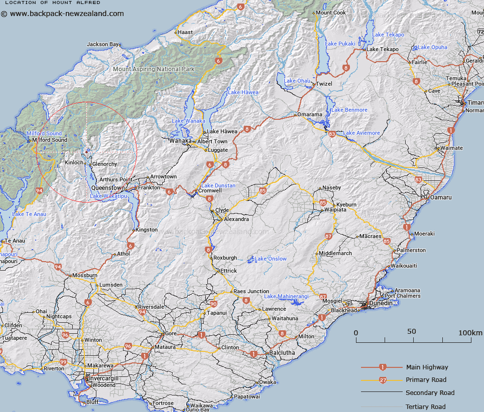
Map showing location of Mount Alfred


LINZ description: Feature shown on: NZMS260-E40 429953; Infomap 346-02 Te Wai Pounamu Edition 1 1995; NZTopo50-CB10 328335
Latitude: -44.757157
Longitude: 168.361265
Northing: 5033549.6
Easting: 1232852
Land District: Otago
Feat Type: Hill


Scroll down to see a more detailed road map and below that a topographical map showing the location of Mount Alfred. The road map has been supplied by openstreetmap and the topographical map of Mount Alfred has been supplied by Land Information New Zealand (LINZ).

Yes you can use the top static map for you school/university project or personal website with a link back. Contact me for any commercial use.

Mount Alfred Map New Zealand


New Zealand places in our database
[ A ] [ B ] [ C ] [ D ] [ E ] [ F ] [ G ] [ H ] [ I ] [ J ] [ K ] [ L ] [ M ] [ N ] [ O ] [ P ] [ Q ] [ R ] [ S ] [ T ] [ U ] [ V ] [ W ] [ X ] [ Y ] [ Z ]


Closest 20 Hills to Mount Alfred

Mount Alfred ( 0km )   Mount Alfred/Ari ( 0km )   Camp Hill ( 4.12km )   Upper Peak ( 7.78km )   Sugar Loaf ( 8.21km )   Precipice Hill ( 8.98km )   Mount Bonpland ( 10.08km )   Temple Peak ( 10.77km )   Turret Head ( 11.06km )   Bold Peak ( 11.09km )   Cone Hill ( 11.28km )   Mount McIntosh ( 11.45km )   Black Peak ( 11.87km )   Stair Peak ( 12.01km )   Emily Peak ( 12.41km )   Momus ( 12.77km )   Mount Judah ( 12.94km )   Round Hill ( 13.21km )   Round Hill Peak ( 13.22km )   Ocean Peak ( 14.33km )   Mount Xenicus ( 14.4km )   Mount Nox ( 14.66km )   Black Peak ( 14.68km )   Mount Alaska ( 14.79km )   Mount Erebus ( 14.82km )   West Peak ( 14.87km )   Mount Earnslaw/Pikirakatahi ( 15.09km )   Mount Earnslaw ( 15.09km )   Mount Buck ( 15.11km )   Somnus ( 15.15km )   Harris Saddle ( 15.3km )   Harris Saddle/Tarahaka Whakatipu ( 15.3km )   East Peak ( 15.49km )   Conical Hill ( 15.7km )   Pluto Peak ( 15.89km )   Leary Peak ( 16.55km )   O'Leary Peak ( 16.55km )   Stone Peak ( 16.67km )   Mount Butement ( 16.71km )   Mount Larkins ( 17.05km )