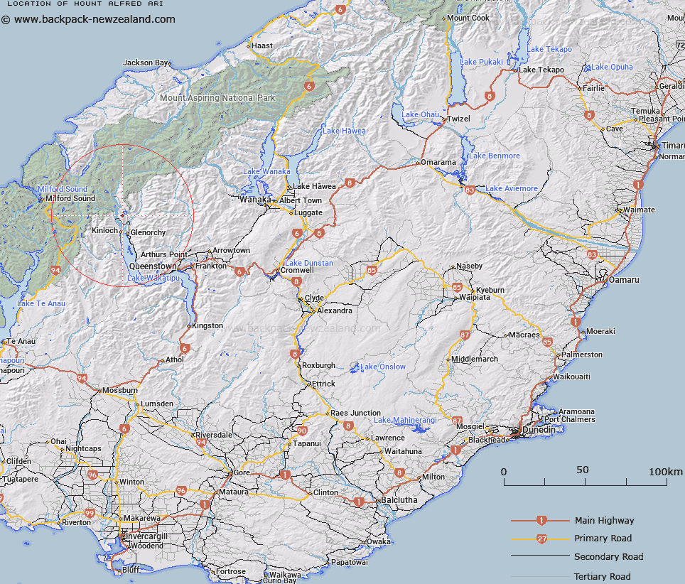
Map showing location of Mount Alfred/Ari


LINZ description: Feature shown on: NZMS260-E40 429953; Infomap 346-02 Te Wai Pounamu Edition 1 1995; NZTopo50-CB10 328335
Latitude: -44.757157
Longitude: 168.361265
Northing: 5033549.6
Easting: 1232852
Land District: Otago
Feat Type: Hill


Scroll down to see a more detailed road map and below that a topographical map showing the location of Mount Alfred/Ari. The road map has been supplied by openstreetmap and the topographical map of Mount Alfred/Ari has been supplied by Land Information New Zealand (LINZ).

Yes you can use the top static map for you school/university project or personal website with a link back. Contact me for any commercial use.
Mount Alfred/Ari Map New Zealand


New Zealand places in our database
[ A ] [ B ] [ C ] [ D ] [ E ] [ F ] [ G ] [ H ] [ I ] [ J ] [ K ] [ L ] [ M ] [ N ] [ O ] [ P ] [ Q ] [ R ] [ S ] [ T ] [ U ] [ V ] [ W ] [ X ] [ Y ] [ Z ]


Closest 20 Hills to Mount Alfred/Ari

Mount Alfred ( 0km )   Mount Alfred/Ari ( 0km )   Camp Hill ( 4.12km )   Upper Peak ( 7.78km )   Sugar Loaf ( 8.21km )   Precipice Hill ( 8.98km )   Mount Bonpland ( 10.08km )   Temple Peak ( 10.77km )   Turret Head ( 11.06km )   Bold Peak ( 11.09km )   Cone Hill ( 11.28km )   Mount McIntosh ( 11.45km )   Black Peak ( 11.87km )   Stair Peak ( 12.01km )   Emily Peak ( 12.41km )   Momus ( 12.77km )   Mount Judah ( 12.94km )   Round Hill ( 13.21km )   Round Hill Peak ( 13.22km )   Ocean Peak ( 14.33km )   Mount Xenicus ( 14.4km )   Mount Nox ( 14.66km )   Black Peak ( 14.68km )   Mount Alaska ( 14.79km )   Mount Erebus ( 14.82km )   West Peak ( 14.87km )   Mount Earnslaw/Pikirakatahi ( 15.09km )   Mount Earnslaw ( 15.09km )   Mount Buck ( 15.11km )   Somnus ( 15.15km )   Harris Saddle ( 15.3km )   Harris Saddle/Tarahaka Whakatipu ( 15.3km )   East Peak ( 15.49km )   Conical Hill ( 15.7km )   Pluto Peak ( 15.89km )   Leary Peak ( 16.55km )   O'Leary Peak ( 16.55km )   Stone Peak ( 16.67km )   Mount Butement ( 16.71km )   Mount Larkins ( 17.05km )