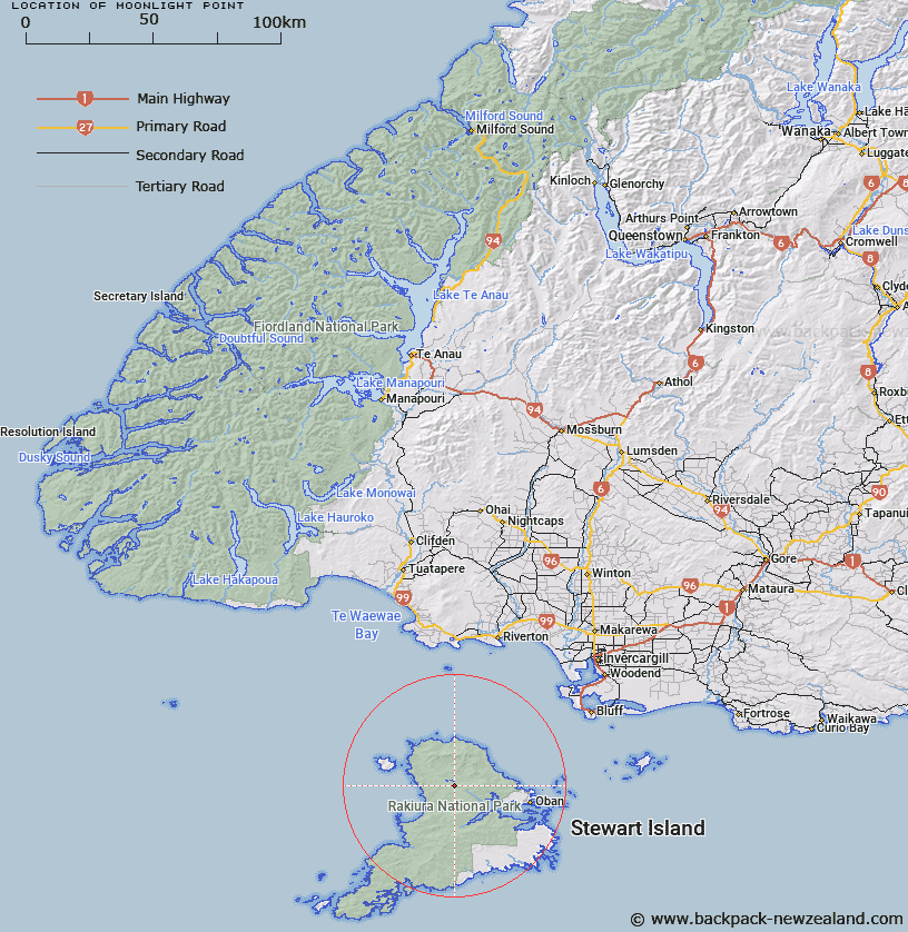
Map showing location of Moonlight Point


LINZ description: Locality at bend in Freshwater River below Trig. G (Geodetic Code A02G), at western end of Thomson Ridge, Stewart Island. Mason Survey District.
Latitude: -46.843132
Longitude: 167.868296
Northing: 4799469.9
Easting: 1208752.4
Land District: Southland
Feat Type: Point


Scroll down to see a more detailed road map and below that a topographical map showing the location of Moonlight Point. The road map has been supplied by openstreetmap and the topographical map of Moonlight Point has been supplied by Land Information New Zealand (LINZ).

Yes you can use the top static map for you school/university project or personal website with a link back. Contact me for any commercial use.

Moonlight Point Map New Zealand


New Zealand places in our database
[ A ] [ B ] [ C ] [ D ] [ E ] [ F ] [ G ] [ H ] [ I ] [ J ] [ K ] [ L ] [ M ] [ N ] [ O ] [ P ] [ Q ] [ R ] [ S ] [ T ] [ U ] [ V ] [ W ] [ X ] [ Y ] [ Z ]


Closest 20 Points to Moonlight Point

Mason Head ( 9.42km )   Richards Point ( 10.88km )   North Arm Point ( 12.8km )   Garden Point ( 12.88km )   Ogles Point ( 13.26km )   Gull Rock Point ( 13.43km )   Dynamite Point ( 13.99km )   Harry West Bay ( 14.38km )   Harry West Point ( 14.38km )   Saddle Point ( 15.8km )   Lucky Point ( 16.1km )   Allans Point ( 16.29km )   White Rock Point ( 16.33km )   North Red Head ( 16.38km )   Prices Point ( 16.96km )   Kaipipi Point ( 17.14km )   Peters Point ( 17.47km )   Black Rock Point ( 17.67km )   Cave Point ( 18.32km )   Putatara Point ( 18.33km )   Trumpeter Point ( 18.66km )   Cow and Calf Point ( 19.05km )   Bobs Point ( 19.74km )   Roger Head ( 20.25km )   McArthurs Head ( 20.37km )   Bull Point ( 20.83km )   Hicks Point ( 20.83km )   Louis Point ( 20.94km )   Mamaku Point ( 21.07km )   Peterson Point ( 21.19km )   Macrae Point ( 21.33km )   Lonnekers Point ( 21.45km )   Horseshoe Point ( 21.67km )   Bragg Point ( 21.67km )   Fly Point ( 21.77km )   Wast Point ( 21.87km )   Flagstaff Point ( 22.04km )   Ringaringa Point ( 22.1km )   Fisherman Point ( 22.63km )   Burnt Point ( 22.91km )