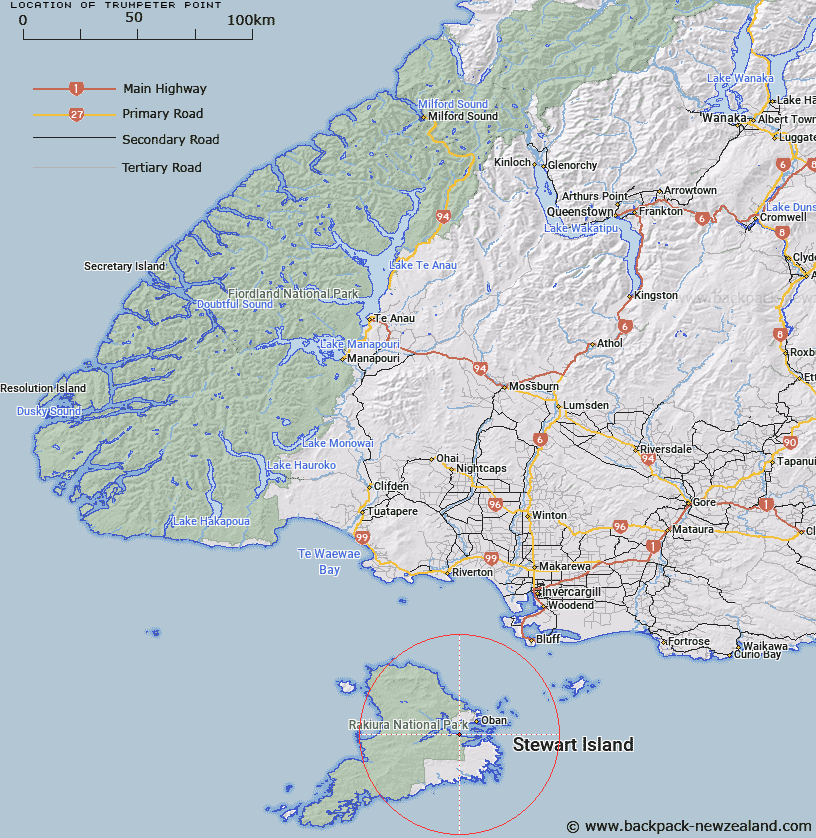
Map showing location of Trumpeter Point


LINZ description: Prominent point 2.5km East of Abraham Bay, Paterson Inlet, Stewart Island. Paterson Survey District.
Latitude: -46.946789
Longitude: 168.061414
Northing: 4788900
Easting: 1224200
Land District: Southland
Feat Type: Point


Scroll down to see a more detailed road map and below that a topographical map showing the location of Trumpeter Point. The road map has been supplied by openstreetmap and the topographical map of Trumpeter Point has been supplied by Land Information New Zealand (LINZ).

Yes you can use the top static map for you school/university project or personal website with a link back. Contact me for any commercial use.

Trumpeter Point Map New Zealand


New Zealand places in our database
[ A ] [ B ] [ C ] [ D ] [ E ] [ F ] [ G ] [ H ] [ I ] [ J ] [ K ] [ L ] [ M ] [ N ] [ O ] [ P ] [ Q ] [ R ] [ S ] [ T ] [ U ] [ V ] [ W ] [ X ] [ Y ] [ Z ]


Closest 20 Points to Trumpeter Point

Bull Point ( 2.23km )   Prices Point ( 3.23km )   Allans Point ( 4.2km )   Kaipipi Point ( 4.26km )   Harry West Point ( 4.29km )   Harry West Bay ( 4.29km )   Burnt Point ( 4.58km )   Dynamite Point ( 4.9km )   Cow and Calf Point ( 5.17km )   Flagstaff Point ( 5.85km )   North Arm Point ( 6.16km )   Ogles Point ( 7.11km )   Ringaringa Point ( 7.18km )   Peterson Point ( 7.57km )   Macrae Point ( 7.73km )   Lonnekers Point ( 7.87km )   Hicks Point ( 7.87km )   Fly Point ( 8.24km )   Louis Point ( 8.38km )   Wast Point ( 8.42km )   Chasland Point ( 8.51km )   Schoolhouse Point ( 8.58km )   High Point ( 8.86km )   Bragg Point ( 9.07km )   Fisherman Point ( 9.3km )   Steep Head ( 9.59km )   Ackers Point ( 9.63km )   Fifes Point ( 10.01km )   Horseshoe Point ( 10.08km )   Bullers Point (Anglem) ( 10.5km )   Bullers Point ( 10.5km )   Peters Point ( 10.94km )   Mamaku Point ( 11.36km )   Bobs Point ( 11.38km )   Chew Tobacco Point ( 12.82km )   Kuri Point ( 12.82km )   Sprat Point ( 14.51km )   Pikaroro Point ( 15.42km )   Browns Garden ( 16.47km )   Gull Rock Point ( 16.49km )