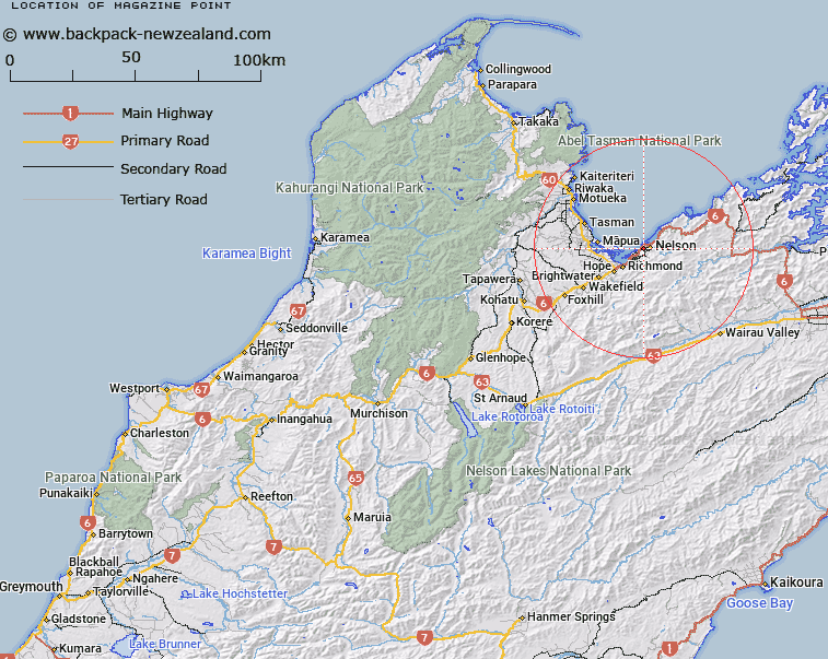
Map showing location of Magazine Point
LINZ description: Located on the south shore of Tasman Bay / Te Tai-o-Aorere, adjacent to Nelson city. Depicted on Chart NZ 6142.; NZTopo50-BQ26 214307
Latitude: -41.275333
Longitude: 173.256167
Northing: 5430646
Easting: 1621454.1
Land District: Nelson
Feat Type: Coast Feature
Latitude: -41.275333
Longitude: 173.256167
Northing: 5430646
Easting: 1621454.1
Land District: Nelson
Feat Type: Coast Feature

Scroll down to see a more detailed road map and below that a topographical map showing the location of Magazine Point. The road map has been supplied by openstreetmap and the topographical map of Magazine Point has been supplied by Land Information New Zealand (LINZ).
Yes you can use the top static map for you school/university project or personal website with a link back. Contact me for any commercial use.
[ A ] [ B ] [ C ] [ D ] [ E ] [ F ] [ G ] [ H ] [ I ] [ J ] [ K ] [ L ] [ M ] [ N ] [ O ] [ P ] [ Q ] [ R ] [ S ] [ T ] [ U ] [ V ] [ W ] [ X ] [ Y ] [ Z ]