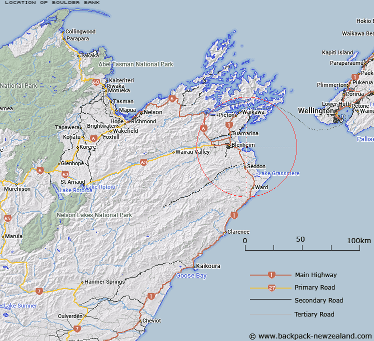
Map showing location of Boulder Bank
LINZ description: A boulder bank approximately 8 km long aligned northwest-southeast between Wairau River mouth and White Bluffs / Te Parinui o Whiti in Te Koko-o-Kupe / Cloudy Bay approximately 11 km east of Blenheim. NZTopo50-BR29 914025.
Latitude: -41.525229
Longitude: 174.09466
Northing: 5402356.4
Easting: 1691328.6
Land District: Marlborough
Feat Type: Coast Feature
Latitude: -41.525229
Longitude: 174.09466
Northing: 5402356.4
Easting: 1691328.6
Land District: Marlborough
Feat Type: Coast Feature

Scroll down to see a more detailed road map and below that a topographical map showing the location of Boulder Bank. The road map has been supplied by openstreetmap and the topographical map of Boulder Bank has been supplied by Land Information New Zealand (LINZ).
Yes you can use the top static map for you school/university project or personal website with a link back. Contact me for any commercial use.
[ A ] [ B ] [ C ] [ D ] [ E ] [ F ] [ G ] [ H ] [ I ] [ J ] [ K ] [ L ] [ M ] [ N ] [ O ] [ P ] [ Q ] [ R ] [ S ] [ T ] [ U ] [ V ] [ W ] [ X ] [ Y ] [ Z ]