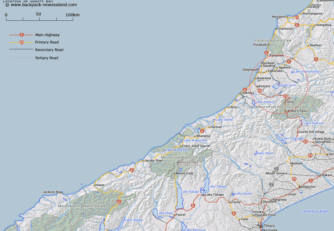
Map showing location of Howitt Bay


LINZ description: Bay to south of Crooked River mouth in Lake Brunner
Latitude: -42.606921
Longitude: 171.470013
Northing: 5281700
Easting: 1474500
Land District: Westland
Feat Type: Bay


Scroll down to see a more detailed road map and below that a topographical map showing the location of Howitt Bay. The road map has been supplied by openstreetmap and the topographical map of Howitt Bay has been supplied by Land Information New Zealand (LINZ).

Yes you can use the top static map for you school/university project or personal website with a link back. Contact me for any commercial use.

Howitt Bay Map New Zealand


New Zealand places in our database
[ A ] [ B ] [ C ] [ D ] [ E ] [ F ] [ G ] [ H ] [ I ] [ J ] [ K ] [ L ] [ M ] [ N ] [ O ] [ P ] [ Q ] [ R ] [ S ] [ T ] [ U ] [ V ] [ W ] [ X ] [ Y ] [ Z ]


Closest 20 Bays to Howitt Bay

Pah Bay ( 0.99km )   Iveagh Bay ( 2.15km )   Cashmere Bay ( 2.24km )   Molloy Bay ( 2.59km )   Dobson Bay ( 4.38km )   Uncle Bay ( 5.34km )   Bain Bay ( 5.4km )   Swan Bay ( 5.82km )   Clematis Bay ( 5.94km )   Carew Bay ( 6.44km )   Hans Bay ( 34.06km )   Canoe Cove ( 34.66km )   Sunny Bight ( 35.43km )   Big Bay ( 36.48km )   Christmas Bay ( 36.5km )   Camp Bay ( 36.58km )   Slip Bay ( 38.62km )   Picnic Bay ( 49km )   Grebe Bay ( 49.29km )   Daylight Bight ( 49.94km )   Shanghai Bay ( 50.83km )   Home Bay ( 57.54km )   Irimahuwheri Bay ( 59.33km )   Shoal Bay ( 59.45km )   Pinafore Bay ( 59.69km )   Meybille Bay ( 60.21km )   Mabel Bay ( 60.21km )   Ritchies Bay ( 60.44km )   Hatters Bay ( 61.19km )   Marion Bay ( 61.88km )   Breaksea Bay ( 62.55km )   Swell Bay ( 63.79km )   Woodpecker Bay ( 65.74km )   Smuggler Cove ( 77.85km )   Doctor Bay ( 78.26km )   Constant Bay ( 78.48km )   Joyce Bay ( 78.66km )   Deerprint Cove ( 81.51km )   Benford Bay ( 84.49km )   Tauranga Bay ( 93.12km )