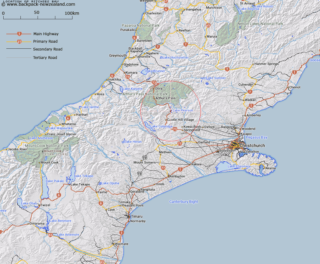
Map showing location of Ritchies Bay


LINZ description: Bay in Lake Pearson, on Main Road to West Coast on west side of Lake approximately half way along.
Latitude: -43.101876
Longitude: 171.776337
Northing: 5227145.4
Easting: 1500425.7
Land District: Canterbury
Feat Type: Bay


Scroll down to see a more detailed road map and below that a topographical map showing the location of Ritchies Bay. The road map has been supplied by openstreetmap and the topographical map of Ritchies Bay has been supplied by Land Information New Zealand (LINZ).

Yes you can use the top static map for you school/university project or personal website with a link back. Contact me for any commercial use.

Ritchies Bay Map New Zealand


New Zealand places in our database
[ A ] [ B ] [ C ] [ D ] [ E ] [ F ] [ G ] [ H ] [ I ] [ J ] [ K ] [ L ] [ M ] [ N ] [ O ] [ P ] [ Q ] [ R ] [ S ] [ T ] [ U ] [ V ] [ W ] [ X ] [ Y ] [ Z ]


Closest 20 Bays to Ritchies Bay

Smuggler Cove ( 18.2km )   Deerprint Cove ( 21.66km )   Home Bay ( 54.41km )   Shoal Bay ( 55.05km )   Uncle Bay ( 56.06km )   Slip Bay ( 56.47km )   Pinafore Bay ( 56.72km )   Swan Bay ( 57.02km )   Big Bay ( 57.64km )   Camp Bay ( 58km )   Marion Bay ( 58.27km )   Breaksea Bay ( 58.28km )   Swell Bay ( 58.31km )   Iveagh Bay ( 58.38km )   Cashmere Bay ( 58.71km )   Christmas Bay ( 58.83km )   Clematis Bay ( 59.21km )   Pah Bay ( 59.45km )   Howitt Bay ( 60.44km )   Hans Bay ( 60.49km )   Carew Bay ( 60.69km )   Harrisons Bight ( 61.5km )   Canoe Cove ( 61.59km )   Bain Bay ( 61.72km )   Sunny Bight ( 62.12km )   Dobson Bay ( 62.28km )   Molloy Bay ( 62.39km )   Picnic Bay ( 76.71km )   Daylight Bight ( 77.26km )   Grebe Bay ( 77.85km )   Shanghai Bay ( 78.79km )   Pegasus Bay ( 84.21km )   McCormacks Bay ( 91.69km )   Governors Bay ( 91.96km )   Rapaki Bay ( 92.37km )   Motukauatirahi Bay ( 92.98km )   Motukauatirahi/Cass Bay ( 92.98km )   Cass Bay ( 92.98km )   Corsair Bay ( 93.5km )   Motukauatiiti/Corsair Bay ( 93.5km )