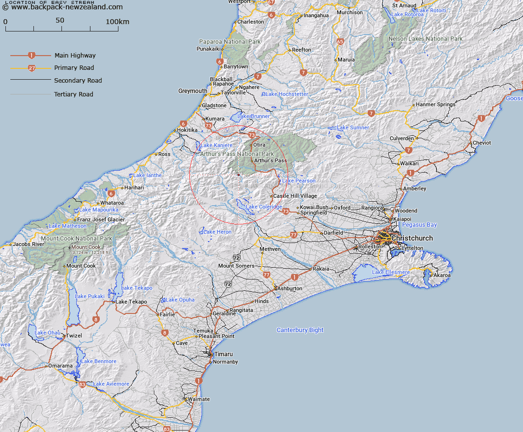
Map showing location of Easy Stream


LINZ description: Left bank tributary of Avoca River, rising in the Black Range, South of Sphinx Saddle, flowing southward and joining Avoca River 2.7km South of Sphinx Saddle. Block IV Wilberforce Survey District.
Latitude: -43.049237
Longitude: 171.462162
Northing: 5232570
Easting: 1474752.5
Land District: Canterbury
Feat Type: Stream


Scroll down to see a more detailed road map and below that a topographical map showing the location of Easy Stream. The road map has been supplied by openstreetmap and the topographical map of Easy Stream has been supplied by Land Information New Zealand (LINZ).

Yes you can use the top static map for you school/university project or personal website with a link back. Contact me for any commercial use.

Easy Stream Map New Zealand


New Zealand places in our database
[ A ] [ B ] [ C ] [ D ] [ E ] [ F ] [ G ] [ H ] [ I ] [ J ] [ K ] [ L ] [ M ] [ N ] [ O ] [ P ] [ Q ] [ R ] [ S ] [ T ] [ U ] [ V ] [ W ] [ X ] [ Y ] [ Z ]


Closest 20 Streams to Easy Stream

Blind Creek ( 1.66km )   Avoca River ( 2.17km )   Galilee Creek ( 2.87km )   Anti Crow River ( 3.35km )   Hanging Valley Creek ( 4.1km )   Chamois Stream ( 4.37km )   Basin Creek ( 5.29km )   Jordan Stream ( 5.37km )   Junction Stream ( 5.67km )   Little Jordan Stream ( 5.84km )   Front Basin Stream ( 5.84km )   Amphitheatre Creek ( 5.85km )   Greenlaw Creek ( 6.06km )   Harper Creek ( 7.16km )   Hanging Basin Creek ( 7.65km )   Mid Basin Creek ( 7.65km )   Power Stream ( 8.06km )   Burnet Stream ( 8.45km )   Crow River ( 9.33km )   Bristed Stream ( 9.67km )   White River ( 9.82km )   Triangle Creek ( 9.89km )   Fanghill Stream ( 9.94km )   Bruce Stream ( 10.22km )   Weka Stream ( 10.36km )   Denas Creek ( 10.55km )   Long Creek ( 10.76km )   Windy Creek ( 11.16km )   Halpin Creek ( 11.29km )   Greyneys Creek ( 11.51km )   Taipoiti River ( 11.66km )   Gulch Creek ( 11.87km )   Centre Creek ( 11.91km )   Cronin Stream ( 12km )   Arthurs Creek ( 12.08km )   Sylvia Creek ( 12.25km )   Cameron Creek ( 12.69km )   Boundary Stream ( 12.79km )   Rough Creek ( 13.11km )   Puny Creek ( 13.13km )