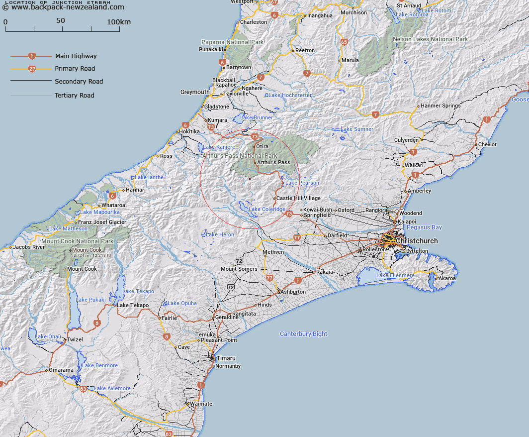
Map showing location of Junction Stream


LINZ description: Stream rising under Blind Spur east of Black Range flowing east into Bruce Stream
Latitude: -43.06238
Longitude: 171.529545
Northing: 5231208.8
Easting: 1480266
Land District: Canterbury
Feat Type: Stream


Scroll down to see a more detailed road map and below that a topographical map showing the location of Junction Stream. The road map has been supplied by openstreetmap and the topographical map of Junction Stream has been supplied by Land Information New Zealand (LINZ).

Yes you can use the top static map for you school/university project or personal website with a link back. Contact me for any commercial use.

Junction Stream Map New Zealand


New Zealand places in our database
[ A ] [ B ] [ C ] [ D ] [ E ] [ F ] [ G ] [ H ] [ I ] [ J ] [ K ] [ L ] [ M ] [ N ] [ O ] [ P ] [ Q ] [ R ] [ S ] [ T ] [ U ] [ V ] [ W ] [ X ] [ Y ] [ Z ]


Closest 20 Streams to Junction Stream

Amphitheatre Creek ( 2.67km )   Little Jordan Stream ( 3km )   Galilee Creek ( 3km )   Power Stream ( 3.59km )   Jordan Stream ( 3.9km )   Blind Creek ( 4.51km )   Long Creek ( 5.1km )   Bruce Stream ( 5.23km )   Windy Creek ( 5.56km )   Easy Stream ( 5.67km )   Anti Crow River ( 6.63km )   Chamois Stream ( 6.83km )   Front Basin Stream ( 6.84km )   Avoca River ( 7.66km )   Mangos Creek ( 7.75km )   Basin Creek ( 7.99km )   Tarn Creek ( 8.04km )   Mid Basin Creek ( 8.08km )   Hanging Basin Creek ( 8.53km )   Centre Creek ( 8.76km )   Greyneys Creek ( 9.02km )   Doubtful Creek ( 9.04km )   Hanging Valley Creek ( 9.4km )   Broad Stream ( 9.42km )   Fall Creek ( 9.43km )   Greenlaw Creek ( 9.66km )   Halpin Creek ( 9.69km )   Triangle Creek ( 9.83km )   Sawmill Stream ( 9.97km )   Crow River ( 10.01km )   McKay Stream ( 10.53km )   Harper Creek ( 11.13km )   Hidden Creek ( 11.19km )   Hamilton Creek ( 11.74km )   Snow Creek ( 11.84km )   Bretts Stream ( 11.99km )   Cockayne Creek ( 12.03km )   Corner Creek ( 12.08km )   Lilian Creek ( 12.19km )   Rough Creek ( 12.55km )