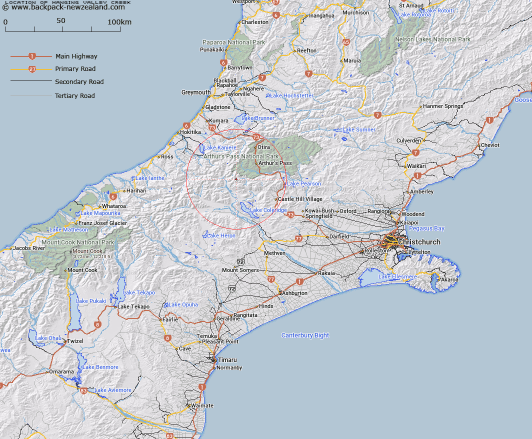
Map showing location of Hanging Valley Creek


LINZ description: Right bank tributary of the Avoca River, rising below Half Moon Saddle, and flowing northwards between the Birdwood and Tobacco Ranges. Wilberforce Survey District.
Latitude: -43.059832
Longitude: 171.41388
Northing: 5231320.1
Easting: 1470842.3
Land District: Canterbury
Feat Type: Stream


Scroll down to see a more detailed road map and below that a topographical map showing the location of Hanging Valley Creek. The road map has been supplied by openstreetmap and the topographical map of Hanging Valley Creek has been supplied by Land Information New Zealand (LINZ).

Yes you can use the top static map for you school/university project or personal website with a link back. Contact me for any commercial use.

Hanging Valley Creek Map New Zealand


New Zealand places in our database
[ A ] [ B ] [ C ] [ D ] [ E ] [ F ] [ G ] [ H ] [ I ] [ J ] [ K ] [ L ] [ M ] [ N ] [ O ] [ P ] [ Q ] [ R ] [ S ] [ T ] [ U ] [ V ] [ W ] [ X ] [ Y ] [ Z ]


Closest 20 Streams to Hanging Valley Creek

Avoca River ( 1.94km )   Easy Stream ( 4.1km )   Basin Creek ( 4.45km )   Chamois Stream ( 4.46km )   Burnet Stream ( 4.61km )   Bristed Stream ( 5.67km )   Blind Creek ( 5.74km )   Front Basin Stream ( 6.23km )   Galilee Creek ( 6.4km )   Anti Crow River ( 6.48km )   Fanghill Stream ( 6.73km )   Weka Stream ( 6.83km )   Hanging Basin Creek ( 7.35km )   Mid Basin Creek ( 7.71km )   Greenlaw Creek ( 7.92km )   Denas Creek ( 8.3km )   Harper Creek ( 8.37km )   Amphitheatre Creek ( 8.72km )   Junction Stream ( 9.4km )   Jordan Stream ( 9.43km )   Gulch Creek ( 9.6km )   Triangle Creek ( 9.72km )   Little Jordan Stream ( 9.94km )   Arthurs Creek ( 9.97km )   Wilberforce River ( 10.21km )   Cameron Creek ( 10.26km )   Sylvia Creek ( 10.41km )   White River ( 10.47km )   Cronin Stream ( 10.73km )   Gifford Stream ( 10.73km )   Puny Creek ( 10.94km )   Pfahlert Creek ( 10.98km )   Boundary Stream ( 11.08km )   Griffiths Stream ( 11.58km )   Fiddes Creek ( 11.63km )   Snowy Creek ( 11.87km )   Bauckes Creek ( 12.08km )   Kea Creek ( 12.09km )   Power Stream ( 12.12km )   Speciman Creek ( 12.2km )