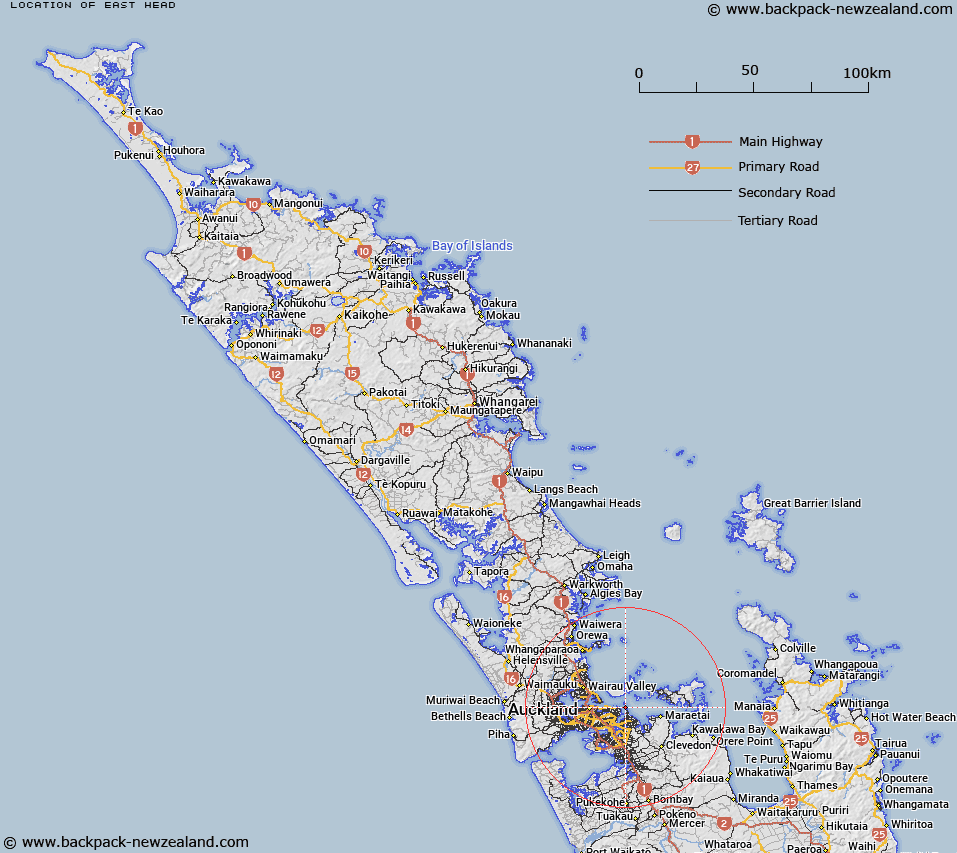
Map showing location of East Head


LINZ description: A coastal point at the end of a peninsula which projects into the Tamaki Strait towards Browns Island (Motukorea). NZTopo50-BA32 695205.
Latitude: -36.847122
Longitude: 174.901108
Northing: 5920400
Easting: 1769500
Land District: North Auckland
Feat Type: Point


Scroll down to see a more detailed road map and below that a topographical map showing the location of East Head. The road map has been supplied by openstreetmap and the topographical map of East Head has been supplied by Land Information New Zealand (LINZ).

Yes you can use the top static map for you school/university project or personal website with a link back. Contact me for any commercial use.

East Head Map New Zealand


New Zealand places in our database
[ A ] [ B ] [ C ] [ D ] [ E ] [ F ] [ G ] [ H ] [ I ] [ J ] [ K ] [ L ] [ M ] [ N ] [ O ] [ P ] [ Q ] [ R ] [ S ] [ T ] [ U ] [ V ] [ W ] [ X ] [ Y ] [ Z ]


Closest 20 Points to East Head

East Head ( 0km )   Musick Point ( 0km )   West Tamaki Head ( 2.33km )   Tahuna Torea ( 2.87km )   Sandy Point ( 2.87km )   Achilles Point ( 3.35km )   Gower Point ( 4.53km )   Point England ( 4.81km )   Mangoparerua ( 5.5km )   Emu Point ( 5.7km )   Cemetery Point ( 6.12km )   Te Tumurae ( 6.12km )   Te Raeokahu ( 6.36km )   Guys Cliff ( 6.36km )   Bastion Point ( 6.84km )   Flax Point ( 7.3km )   Otahuhu Point ( 7.31km )   Takaparawha Point ( 7.47km )   North Head ( 8.02km )   Hobson Point ( 8.53km )   Park Point (Te Roreomaiaea) ( 8.78km )   Te Rere Point ( 8.85km )   Takapuna Head ( 9.03km )   Te Whetumatarau Point ( 9.14km )   Schnapper Point ( 9.35km )   Hangaura Point ( 9.74km )   Point Resolution ( 9.81km )   Mahuehue Point ( 9.84km )   Maunganui Point ( 10.47km )   Duders Point ( 10.91km )   Kennedy Point ( 11.37km )   Te Whau Point ( 11.47km )   Matenga Point ( 11.48km )   Stanley Point ( 11.53km )   O'Neills Point ( 12.27km )   Billy Goat Point ( 13.05km )   Barrys Point ( 13.16km )   Hakaimango Point ( 13.41km )   South Point ( 13.7km )   Stokes Point ( 13.86km )