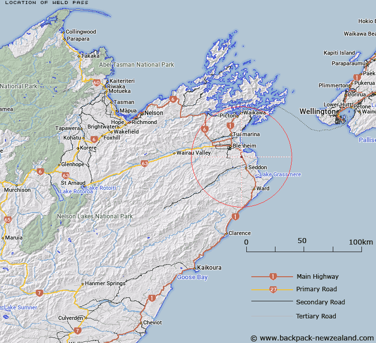
Map showing location of Weld Pass


LINZ description: Pass on th e Picton-Christchurch State Highway (SH1) above Pukapuka Stream and Utawai Creek, south east of Blenheim, south west of Cloudy Bay.
Latitude: -41.590929
Longitude: 174.04401
Northing: 5395114.6
Easting: 1687014.6
Land District: Marlborough
Feat Type: Pass


Scroll down to see a more detailed road map and below that a topographical map showing the location of Weld Pass. The road map has been supplied by openstreetmap and the topographical map of Weld Pass has been supplied by Land Information New Zealand (LINZ).

Yes you can use the top static map for you school/university project or personal website with a link back. Contact me for any commercial use.

Weld Pass Map New Zealand


New Zealand places in our database
[ A ] [ B ] [ C ] [ D ] [ E ] [ F ] [ G ] [ H ] [ I ] [ J ] [ K ] [ L ] [ M ] [ N ] [ O ] [ P ] [ Q ] [ R ] [ S ] [ T ] [ U ] [ V ] [ W ] [ X ] [ Y ] [ Z ]


Closest 20 Passs to Weld Pass

Redwood Pass ( 1.78km )   Dashwood Pass ( 1.9km )   Maxwell Pass ( 2.69km )   Taylor Pass ( 7.94km )   Blairich Pass ( 21.38km )   Catsears Saddle ( 22.53km )   Ramshead Saddle ( 27.32km )   Pig Whare Saddle ( 31.88km )   Tomlinsons Saddle ( 39.85km )   Tomahawk Saddle ( 39.93km )   Burnt Saddle ( 40.71km )   Chaytors Saddle ( 41.58km )   Rag Saddle ( 41.67km )   Beehive Saddle ( 42.07km )   Medway Saddle ( 42.43km )   Skippers Saddle ( 42.85km )   Sweets Saddle ( 44.67km )   Kaiuma Saddle ( 48.51km )   Avon Saddle ( 50.31km )   Kenepuru Saddle ( 51.71km )   Totara Saddle ( 55.41km )   Nydia Saddle ( 55.57km )   Calf Saddle ( 56.33km )   Okoha Saddle ( 56.4km )   Richmond Saddle ( 56.57km )   ?p?uri Saddle ( 56.71km )   Mosses Dip ( 57.51km )   Cuckoo Saddle ( 57.97km )   Upcot Saddle ( 58.17km )   Rai Saddle ( 60.45km )   Maungatapu Saddle ( 61.07km )   George Saddle ( 62.35km )   Dun Saddle ( 62.73km )   Ronga Saddle ( 63.18km )   Coppermine Saddle ( 63.38km )   Whangamoa Saddle ( 65.06km )   Weka Saddle ( 65.92km )   T?tara Saddle ( 66.05km )   Haycock Saddle ( 66.4km )   Lowther Saddle ( 66.87km )