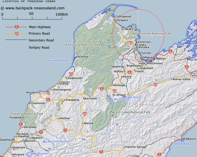
Map showing location of Tregidga Creek


LINZ description: Stream rising 1km South-west of Bare Knob [Trig. A (Geodetic Code A738), flowing South-eastward into the northern arm of Torrent Bay. Abel Tasman National Park. Block III, Kaiteriteri Survey District.
Latitude: -40.936125
Longitude: 173.035934
Northing: 5468333
Easting: 1603025
Land District: Nelson
Feat Type: Stream


Scroll down to see a more detailed road map and below that a topographical map showing the location of Tregidga Creek. The road map has been supplied by openstreetmap and the topographical map of Tregidga Creek has been supplied by Land Information New Zealand (LINZ).

Yes you can use the top static map for you school/university project or personal website with a link back. Contact me for any commercial use.

Tregidga Creek Map New Zealand


New Zealand places in our database
[ A ] [ B ] [ C ] [ D ] [ E ] [ F ] [ G ] [ H ] [ I ] [ J ] [ K ] [ L ] [ M ] [ N ] [ O ] [ P ] [ Q ] [ R ] [ S ] [ T ] [ U ] [ V ] [ W ] [ X ] [ Y ] [ Z ]


Closest 20 Streams to Tregidga Creek

Kilby Stream ( 1.09km )   Torrent River ( 2.96km )   Huffam Stream ( 2.99km )   Falls River ( 3.17km )   Long Valley Creek ( 3.61km )   Lesson Creek ( 3.76km )   Simonet Creek ( 4.18km )   Long Branch Creek ( 4.6km )   Sigley Creek ( 4.88km )   Tinline Stream ( 4.89km )   Evans Creek ( 5.46km )   Awaroa River ( 6.01km )   Buttress Stream ( 6.57km )   Kur? Creek ( 6.75km )   Table Creek ( 6.78km )   Richardson Stream ( 6.91km )   Camp Creek ( 7.38km )   M?rahau River ( 7.64km )   Venture Creek ( 7.65km )   Wallaby Creek ( 7.98km )   Waterfall Creek ( 8.39km )   Pound Creek ( 9.32km )   Waiharakeke Stream ( 10.42km )   Ot?whero River ( 10.48km )   N?kahi Stream ( 10.57km )   Awapoto River ( 10.7km )   Gold Creek ( 11.71km )   Holyoake Stream ( 12.02km )   T?taranui Stream ( 12.06km )   Anawera Stream ( 12.57km )   Anarewa Stream ( 12.57km )   Peter Creek ( 13.3km )   Wainui River ( 13.36km )   Apahai Creek ( 13.51km )   Glenroy Stream ( 13.92km )   Kaikau Stream ( 14.04km )   Foley Creek ( 14.17km )   Atua Stream ( 14.26km )   The Gorge Creek ( 14.3km )   Riwaka River ( 14.62km )