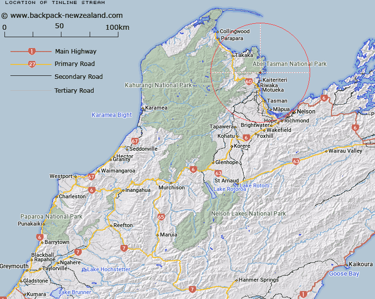
Map showing location of Tinline Stream


LINZ description: Stream rising North-east of Rata Hill [Trig. Z (Geodetic Code A73G), flowing South-eastward into Tinline Bay. Abel Tasman National Park. Block VI, Kaiteriteri Survey District.
Latitude: -40.977953
Longitude: 173.017957
Northing: 5463690.2
Easting: 1601510.7
Land District: Nelson
Feat Type: Stream


Scroll down to see a more detailed road map and below that a topographical map showing the location of Tinline Stream. The road map has been supplied by openstreetmap and the topographical map of Tinline Stream has been supplied by Land Information New Zealand (LINZ).

Yes you can use the top static map for you school/university project or personal website with a link back. Contact me for any commercial use.

Tinline Stream Map New Zealand


New Zealand places in our database
[ A ] [ B ] [ C ] [ D ] [ E ] [ F ] [ G ] [ H ] [ I ] [ J ] [ K ] [ L ] [ M ] [ N ] [ O ] [ P ] [ Q ] [ R ] [ S ] [ T ] [ U ] [ V ] [ W ] [ X ] [ Y ] [ Z ]


Closest 20 Streams to Tinline Stream

Simonet Creek ( 0.91km )   Lesson Creek ( 1.61km )   Torrent River ( 2.24km )   M?rahau River ( 4.12km )   Tregidga Creek ( 4.89km )   Kilby Stream ( 5.06km )   Buttress Stream ( 5.55km )   Falls River ( 6.07km )   Ot?whero River ( 6.6km )   Evans Creek ( 6.91km )   Huffam Stream ( 7.7km )   Anawera Stream ( 7.81km )   Anarewa Stream ( 7.81km )   Holyoake Stream ( 7.81km )   Long Branch Creek ( 7.84km )   Table Creek ( 8.43km )   Long Valley Creek ( 8.47km )   Apahai Creek ( 8.62km )   Sigley Creek ( 8.92km )   Atua Stream ( 9.37km )   Kur? Creek ( 9.39km )   Awaroa River ( 9.51km )   Foley Creek ( 9.66km )   Riwaka River ( 9.8km )   Riuwaka River ( 9.8km )   Camp Creek ( 10.2km )   Gold Creek ( 10.36km )   Waterfall Creek ( 11.5km )   Jordan River ( 11.59km )   Riuwaka River North Branch ( 11.65km )   North Branch Riwaka River ( 11.65km )   Richardson Stream ( 11.77km )   Ferrer Creek ( 11.82km )   Venture Creek ( 12.38km )   Wallaby Creek ( 12.86km )   The Gorge Creek ( 13.51km )   Pound Creek ( 13.73km )   Ironstone Creek ( 13.88km )   Awapoto River ( 14.16km )   Scott Creek ( 14.46km )