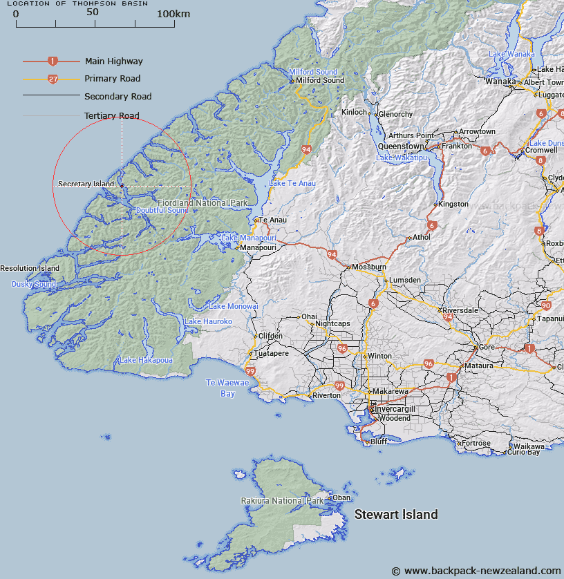
Map showing location of Thompson Basin


LINZ description: Located east of Secretary Island and within Thompson Sound, Fiordland. Maximum depth 342m. NZTopo50 CC05-Colonial Head and CD05-Dagg Sound, Chart NZ7625, Doubtful Sound NW Chart© Irwin & Main 1981D.
Latitude: -45.231782
Longitude: 166.977519
Northing: 4973629.2
Easting: 1127261.1
Land District: Southland
Feat Type: Basin


Scroll down to see a more detailed road map and below that a topographical map showing the location of Thompson Basin. The road map has been supplied by openstreetmap and the topographical map of Thompson Basin has been supplied by Land Information New Zealand (LINZ).

Yes you can use the top static map for you school/university project or personal website with a link back. Contact me for any commercial use.

Thompson Basin Map New Zealand


New Zealand places in our database
[ A ] [ B ] [ C ] [ D ] [ E ] [ F ] [ G ] [ H ] [ I ] [ J ] [ K ] [ L ] [ M ] [ N ] [ O ] [ P ] [ Q ] [ R ] [ S ] [ T ] [ U ] [ V ] [ W ] [ X ] [ Y ] [ Z ]


Closest 20 Basins to Thompson Basin

Deas Basin ( 3.62km )   Open Basin ( 6.87km )   Shelter Basin ( 7.12km )   Grono Basin ( 7.21km )   Seymour Basin ( 8.39km )   Bradshaw Basin ( 8.9km )   Utah Basin ( 9.12km )   Nee Basin ( 9.39km )   Bauza Basin ( 9.39km )   Malaspina Basin ( 10.71km )   Richards Basin ( 11.58km )   Heel Basin ( 11.62km )   Stokes Basin ( 11.88km )   Acheron Basin ( 13.83km )   Precipice Basin ( 14.13km )   Kellard Basin ( 15.37km )   Crooked Basin ( 16.42km )   Secretary Basin ( 16.56km )   Turn Basin ( 18.51km )   Haulashore Basin ( 19.72km )   Nancy Basin ( 21.68km )   Adieu Basin ( 22.3km )   Elizabeth Basin ( 22.93km )   Schooner Basin ( 23km )   Otago Basin ( 23.01km )   Deep Basin ( 27.12km )   Hall Basin ( 27.77km )   Marble Basin ( 28.73km )   Wanganella Basin ( 28.92km )   Walker Basin ( 29.35km )   Wilmot Basin ( 29.88km )   Stillwater Basin ( 30.25km )   Dagg Terrace ( 35.5km )   Dagg Basin ( 35.5km )   Looking Glass Basin ( 39.16km )   South-West Basin ( 44.06km )   Whitewater Basin ( 45.56km )   Elder Basin ( 49.72km )   Breaksea Basin ( 54.19km )   Bligh Basin ( 56.04km )