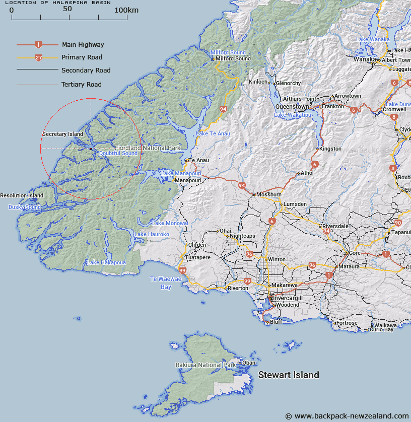
Map showing location of Malaspina Basin
LINZ description: A depression in the sea floor trending north-west, south-east along the length of Malaspina Reach, descending
to a maximum depth of 435m, and located approximately 2km north-west from Matai Island in Doubtful Sound / Patea, Fiordland.
Latitude: -45.32754
Longitude: 166.992631
Northing: 4963080.5
Easting: 1129242.7
Land District: Southland
Feat Type: Basin
Latitude: -45.32754
Longitude: 166.992631
Northing: 4963080.5
Easting: 1129242.7
Land District: Southland
Feat Type: Basin

Scroll down to see a more detailed road map and below that a topographical map showing the location of Malaspina Basin. The road map has been supplied by openstreetmap and the topographical map of Malaspina Basin has been supplied by Land Information New Zealand (LINZ).
Yes you can use the top static map for you school/university project or personal website with a link back. Contact me for any commercial use.
[ A ] [ B ] [ C ] [ D ] [ E ] [ F ] [ G ] [ H ] [ I ] [ J ] [ K ] [ L ] [ M ] [ N ] [ O ] [ P ] [ Q ] [ R ] [ S ] [ T ] [ U ] [ V ] [ W ] [ X ] [ Y ] [ Z ]