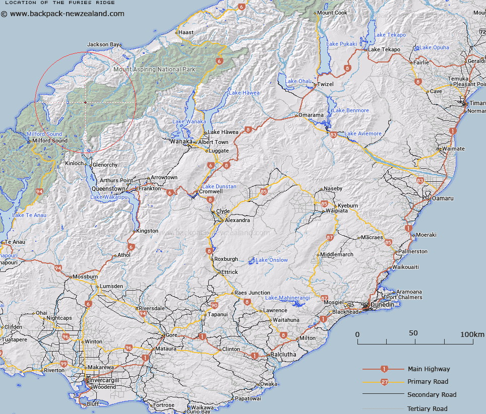
Map showing location of The Furies Ridge


LINZ description: A long rock ridge running west of Gyrac peak, above tributaries of the Pyke River, and south west of the Olivine Range.
Latitude: -44.387046
Longitude: 168.34732
Northing: 5074600
Easting: 1229400
Land District: Otago
Feat Type: Ridge


Scroll down to see a more detailed road map and below that a topographical map showing the location of The Furies Ridge. The road map has been supplied by openstreetmap and the topographical map of The Furies Ridge has been supplied by Land Information New Zealand (LINZ).

Yes you can use the top static map for you school/university project or personal website with a link back. Contact me for any commercial use.

The Furies Ridge Map New Zealand


New Zealand places in our database
[ A ] [ B ] [ C ] [ D ] [ E ] [ F ] [ G ] [ H ] [ I ] [ J ] [ K ] [ L ] [ M ] [ N ] [ O ] [ P ] [ Q ] [ R ] [ S ] [ T ] [ U ] [ V ] [ W ] [ X ] [ Y ] [ Z ]


Closest 20 Ridges to The Furies Ridge

Intervention Ridge ( 5.14km )   Jagged Ridge ( 7.52km )   Retreat Pinnacles ( 7.86km )   Richards Spur ( 22.52km )   Poker Ridge ( 22.87km )   Cribbage Spur ( 23.16km )   Two Peters ( 24.97km )   Awkward Spur ( 25.01km )   Surveyor Ridge ( 26.02km )   Shipowner Ridge ( 26.26km )   Twenty Five Mile Spur ( 27.29km )   Roa Spur ( 27.42km )   Apparition Spur ( 28.25km )   French Ridge ( 28.45km )   North West Ridge ( 28.54km )   Big Devil Spur ( 29.07km )   Hope Spur ( 29.73km )   South West Ridge ( 29.8km )   Moonrise Buttress ( 29.91km )   Martyr Spur ( 30.01km )   Quarry Spur ( 30.45km )   Little Devil Spur ( 30.49km )   Phantom Heights ( 30.52km )   North East Ridge ( 30.64km )   Coxcomb Ridge ( 31.2km )   Haphazard Spur ( 31.82km )   Red Spur ( 32.01km )   Long Charlie Spur ( 32.22km )   Vee Spur ( 32.99km )   Glencairn Spur ( 33.3km )   Lean-to Spur ( 33.61km )   Thirsty Spur ( 34.27km )   Broad Spur ( 34.31km )   Nimbus Ridge ( 34.61km )   Grandeur Ridge ( 34.64km )   Buttress Spur ( 34.98km )   Guide Ridge ( 35.07km )   Bridges Spur ( 35.28km )   Baal Spur ( 35.54km )   Wedge Spur ( 35.87km )