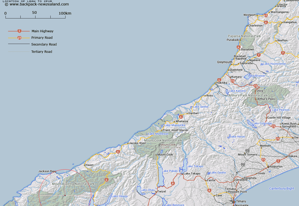
Map showing location of Lean-to Spur


LINZ description: Feature shown on: NZMS260 F39 Edition 1 1993 Reprinted 1995
Latitude: -44.309056
Longitude: 168.755694
Northing: 5085033.6
Easting: 1261480.2
Land District: Westland
Feat Type: Ridge


Scroll down to see a more detailed road map and below that a topographical map showing the location of Lean-to Spur. The road map has been supplied by openstreetmap and the topographical map of Lean-to Spur has been supplied by Land Information New Zealand (LINZ).

Yes you can use the top static map for you school/university project or personal website with a link back. Contact me for any commercial use.

Lean-to Spur Map New Zealand


New Zealand places in our database
[ A ] [ B ] [ C ] [ D ] [ E ] [ F ] [ G ] [ H ] [ I ] [ J ] [ K ] [ L ] [ M ] [ N ] [ O ] [ P ] [ Q ] [ R ] [ S ] [ T ] [ U ] [ V ] [ W ] [ X ] [ Y ] [ Z ]


Closest 20 Ridges to Lean-to Spur

Buttress Spur ( 1.54km )   Haphazard Spur ( 2.52km )   Grandeur Ridge ( 2.63km )   Wedge Spur ( 2.84km )   Phantom Heights ( 3.6km )   Guide Ridge ( 3.92km )   Apparition Spur ( 5.5km )   Beauty Ridge ( 5.57km )   Carter Ridge ( 6.52km )   Razorback Ridge ( 7.43km )   Tantalus Rock ( 7.47km )   Junction Spur ( 7.81km )   North East Ridge ( 7.93km )   North West Ridge ( 8.29km )   Ruth Ridge ( 8.38km )   Quarry Spur ( 8.78km )   Coxcomb Ridge ( 8.78km )   Shipowner Ridge ( 8.92km )   Awkward Spur ( 9.02km )   Two Peters ( 9.02km )   South West Ridge ( 9.38km )   Surveyor Ridge ( 9.54km )   Nimbus Ridge ( 9.66km )   Roa Spur ( 9.83km )   Draughtsman Spur ( 10.15km )   Poker Ridge ( 11.05km )   Cribbage Spur ( 11.41km )   French Ridge ( 13.27km )   Bench Ridge ( 14.31km )   Sheer Spur ( 14.45km )   Jewel Spur ( 15.66km )   Moonrise Buttress ( 15.68km )   Thirsty Spur ( 16.14km )   Baal Spur ( 16.54km )   Saxifrage Spur ( 17.79km )   Erica Spur ( 18.8km )   Drew Spur ( 19.44km )   Awkward Spur ( 21.46km )   Red Spur ( 21.98km )   Lindsay Ridge ( 23.12km )