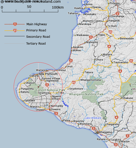
Map showing location of The Big D


LINZ description: A large island in the Waiwhakaiho River, approximately 3.25km above the radius line of the National Park boundary. North-east Egmont.
Latitude: -39.245401
Longitude: 174.097568
Northing: 5655416.4
Easting: 1694712.4
Land District: Taranaki
Feat Type: Island


Scroll down to see a more detailed road map and below that a topographical map showing the location of The Big D. The road map has been supplied by openstreetmap and the topographical map of The Big D has been supplied by Land Information New Zealand (LINZ).

Yes you can use the top static map for you school/university project or personal website with a link back. Contact me for any commercial use.

The Big D Map New Zealand


New Zealand places in our database
[ A ] [ B ] [ C ] [ D ] [ E ] [ F ] [ G ] [ H ] [ I ] [ J ] [ K ] [ L ] [ M ] [ N ] [ O ] [ P ] [ Q ] [ R ] [ S ] [ T ] [ U ] [ V ] [ W ] [ X ] [ Y ] [ Z ]


Closest 20 Islands to The Big D

Motuotamatea (Snapper Rock) ( 21.58km )   Mataora (Round Rock) ( 21.68km )   Pararaki (Seagull Rock) ( 21.76km )   Whareumu (Lion Rock) ( 22.45km )   Waikaranga (Seal Rocks) ( 22.53km )   Ng? Motu/Sugar Loaf Islands ( 22.54km )   Sugar Loaf Islands ( 22.54km )   Tokatapu ( 22.6km )   Moturoa ( 22.62km )   Tokomapuna (Barrett Reef) ( 22.7km )   Motumahanga (Saddleback) ( 23.42km )   Opourapa Island ( 53.18km )   Panirau Island ( 87.05km )   Moutoa Island ( 93.77km )   Moutere Island ( 100.02km )   Corliss Island ( 112.58km )   Whakapapa Island ( 118.49km )   Motunau Rocks ( 124.54km )   Motuopuhi Island ( 139.97km )   Te Motu Island ( 141.06km )   Purimu Rocks ( 141.71km )   Tokapiko Rocks ( 142.04km )   Opeope Rocks ( 142.59km )   Tuapu Island ( 142.6km )   Ayers Rock ( 143.03km )   Motukaraka Island ( 143.75km )   Meurant Island ( 144.67km )   O Wiwi Ku ( 144.67km )   Karewa/Gannet Island ( 147.3km )   Gannet Island (Karewa) ( 147.3km )   Motukahu Rocks ( 147.55km )   Te Rarangi Rocks ( 147.68km )   Maketu Island ( 147.72km )   Kaiwhai Island ( 147.73km )   Jones Island ( 148.56km )   Ngatokakairiri Island ( 148.78km )   Te Kapua Island ( 149.15km )   Motutere Island ( 153.87km )   Motuwhara Island ( 155.68km )   Motukotuku Rocks ( 156.29km )