Map showing location of Te-U-Mukuri Historic Reserve


LINZ description: Was Wellers Rock (Te Umukuri) Historic Reserve
Latitude: -45.797778
Longitude: 170.715
Northing: 4925881.3
Easting: 1422425
Land District: Otago
Feat Type: Historic Reserve


Scroll down to see a more detailed road map and below that a topographical map showing the location of Te-U-Mukuri Historic Reserve. The road map has been supplied by openstreetmap and the topographical map of Te-U-Mukuri Historic Reserve has been supplied by Land Information New Zealand (LINZ).

Yes you can use the top static map for you school/university project or personal website with a link back. Contact me for any commercial use.
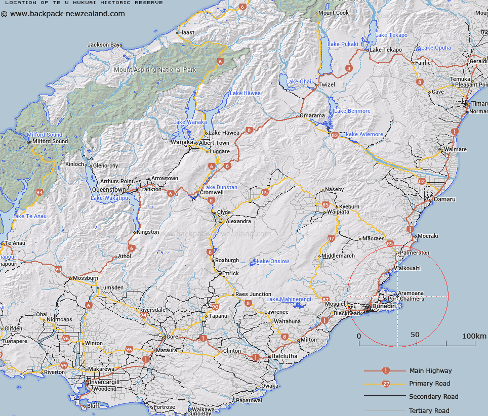
Te-U-Mukuri Historic Reserve Map New Zealand


New Zealand places in our database
[ A ] [ B ] [ C ] [ D ] [ E ] [ F ] [ G ] [ H ] [ I ] [ J ] [ K ] [ L ] [ M ] [ N ] [ O ] [ P ] [ Q ] [ R ] [ S ] [ T ] [ U ] [ V ] [ W ] [ X ] [ Y ] [ Z ]


Closest 20 Historic Reserves to Te-U-Mukuri Historic Reserve

Horseshoe Bend Cemetery Historic Reserve ( 26.09km )   Sir John McKenzie Memorial Historic Reserve ( 34.18km )   Onewhenua Historic Reserve ( 36.11km )   Town of Nenthorn Historic Reserve ( 44.47km )   Katiki Point Historic Reserve ( 46.58km )   Murphys Flat Historic Reserve ( 47.92km )   Kotahitanga Church Historic Reserve ( 49.52km )   Golden Point Historic Reserve ( 54.49km )   Pioneer Stream Historic Reserve ( 66.96km )   Dead Horse Pinch Historic Reserve ( 67.58km )   Gabriels Gully Historic Reserve ( 80.75km )   Gabriel Read Memorial Historic Reserve ( 81.01km )   Alexandra Courthouse Historic Reserve ( 119.39km )   Mitchell's Cottage Historic Reserve ( 121.91km )   Earnscleugh Dredge Tailings Historic Reserve ( 122.9km )   St Bathans Post Office Historic Reserve ( 124.9km )   St Bathans Hall Historic Reserve ( 124.95km )   Shek Harn Historic Reserve ( 133.26km )   Jeanie Collier Grave Site Reserve ( 138.59km )   Bendigo Historic Reserve ( 141.21km )   Bendigo Bake House Historic Reserve ( 144.48km )   Bannockburn Post Office Historic Reserve ( 144.65km )   Quartz Reef Point Historic Reserve ( 145.19km )   Bannockburn Sluicings Historic Reserve ( 146.19km )   Young Australian Historic Reserve ( 146.44km )   Nine Mile Historic Reserve ( 155.6km )   Muddy Gully Historic Reserve ( 159.67km )   Coal Pit Saddle Historic Reserve ( 160.96km )   T?kerehaka Historic Reserve ( 165.27km )   Kawarau Bridge Historic Reserve ( 166.7km )   Monavale Historic Reserve ( 167.66km )   Arrowtown Gaol Historic Reserve ( 175.02km )   Arrowtown Chinese Settlement Historic Reserve ( 175.77km )   Macetown Historic Reserve ( 181.02km )   Queenstown Astronomical Historic Reserve ( 181.03km )   Raincliff Historic Reserve ( 183.14km )   Kakahu Lime Kiln Historic Reserve ( 185.5km )   Atleys Terrace Historic Reserve ( 188.16km )   Invincible Mine Historic Reserve ( 212.47km )   Sand Hill Point Historic Reserve ( 267.06km )