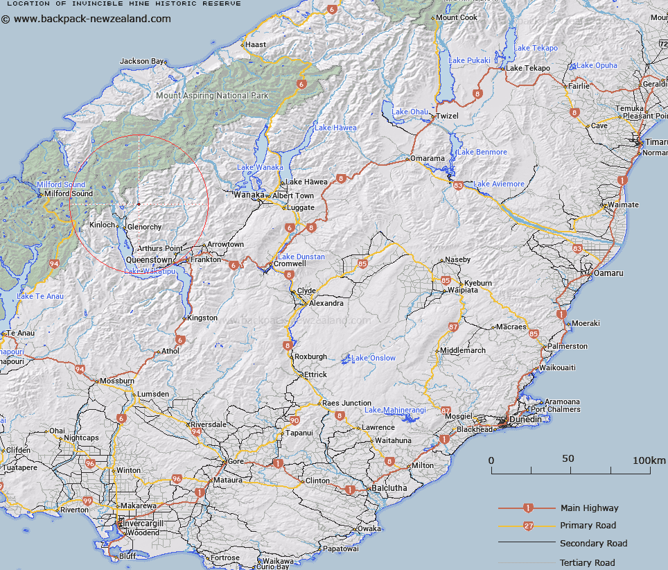
Map showing location of Invincible Mine Historic Reserve


LINZ description: Historic Reserve near Muddy Spur, approximately 20km north-east of Glenorchy.
Latitude: -44.725
Longitude: 168.468333
Northing: 5037600.3
Easting: 1241127.1
Land District: Otago
Feat Type: Historic Reserve


Scroll down to see a more detailed road map and below that a topographical map showing the location of Invincible Mine Historic Reserve. The road map has been supplied by openstreetmap and the topographical map of Invincible Mine Historic Reserve has been supplied by Land Information New Zealand (LINZ).

Yes you can use the top static map for you school/university project or personal website with a link back. Contact me for any commercial use.

Invincible Mine Historic Reserve Map New Zealand


New Zealand places in our database
[ A ] [ B ] [ C ] [ D ] [ E ] [ F ] [ G ] [ H ] [ I ] [ J ] [ K ] [ L ] [ M ] [ N ] [ O ] [ P ] [ Q ] [ R ] [ S ] [ T ] [ U ] [ V ] [ W ] [ X ] [ Y ] [ Z ]


Closest 20 Historic Reserves to Invincible Mine Historic Reserve

Atleys Terrace Historic Reserve ( 26.46km )   Macetown Historic Reserve ( 31.58km )   Arrowtown Chinese Settlement Historic Reserve ( 36.89km )   Arrowtown Gaol Historic Reserve ( 37.6km )   Queenstown Astronomical Historic Reserve ( 37.7km )   Kawarau Bridge Historic Reserve ( 46.38km )   Coal Pit Saddle Historic Reserve ( 52.57km )   Bannockburn Sluicings Historic Reserve ( 66.35km )   Young Australian Historic Reserve ( 66.97km )   Bannockburn Post Office Historic Reserve ( 67.87km )   Quartz Reef Point Historic Reserve ( 68.32km )   T?kerehaka Historic Reserve ( 71.42km )   Bendigo Bake House Historic Reserve ( 72.53km )   Bendigo Historic Reserve ( 75.95km )   Nine Mile Historic Reserve ( 80.48km )   Shek Harn Historic Reserve ( 81.14km )   Earnscleugh Dredge Tailings Historic Reserve ( 90.11km )   Alexandra Courthouse Historic Reserve ( 93.59km )   Mitchell's Cottage Historic Reserve ( 94.27km )   Muddy Gully Historic Reserve ( 103.09km )   St Bathans Hall Historic Reserve ( 107.17km )   St Bathans Post Office Historic Reserve ( 107.17km )   Gabriels Gully Historic Reserve ( 159.49km )   Gabriel Read Memorial Historic Reserve ( 160.74km )   Dead Horse Pinch Historic Reserve ( 164km )   Pioneer Stream Historic Reserve ( 165.85km )   Golden Point Historic Reserve ( 168.86km )   Town of Nenthorn Historic Reserve ( 171.3km )   Murphys Flat Historic Reserve ( 174.91km )   Sand Hill Point Historic Reserve ( 192.05km )   Monavale Historic Reserve ( 195.89km )   Sir John McKenzie Memorial Historic Reserve ( 196.92km )   Kotahitanga Church Historic Reserve ( 199.61km )   Horseshoe Bend Cemetery Historic Reserve ( 200.47km )   Katiki Point Historic Reserve ( 201.86km )   Onewhenua Historic Reserve ( 202.54km )   Jeanie Collier Grave Site Reserve ( 205.51km )   Raincliff Historic Reserve ( 209.95km )   Te-U-Mukuri Historic Reserve ( 212.47km )   Okarito School House Historic Reserve ( 215.01km )