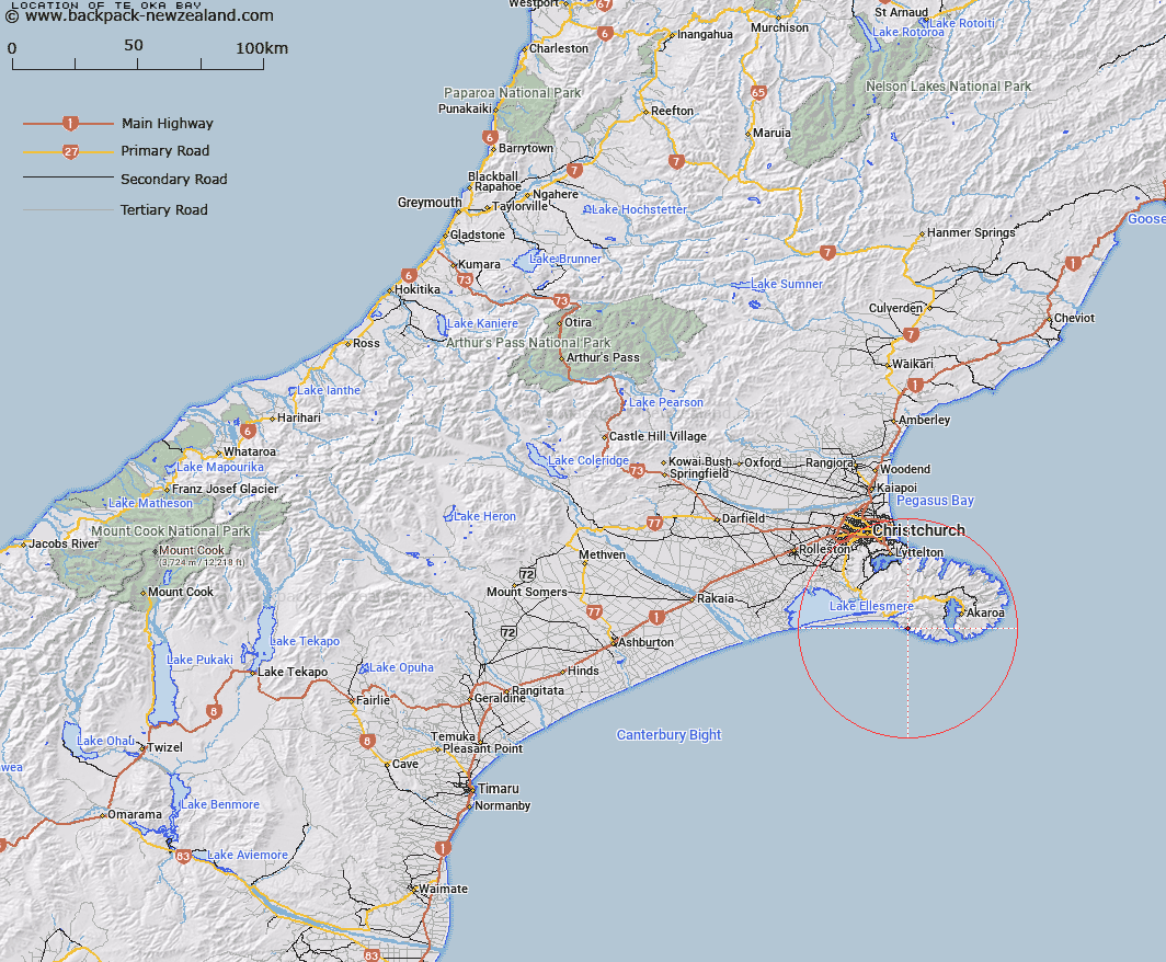
Map showing location of Te Oka Bay


LINZ description: A bay that lies on the south coast of Banks Peninsula in between Tumbledown Bay and Robin Hood Bay.
Latitude: -43.854171
Longitude: 172.778525
Northing: 5144300
Easting: 1582200
Land District: Canterbury
Feat Type: Bay


Scroll down to see a more detailed road map and below that a topographical map showing the location of Te Oka Bay. The road map has been supplied by openstreetmap and the topographical map of Te Oka Bay has been supplied by Land Information New Zealand (LINZ).

Yes you can use the top static map for you school/university project or personal website with a link back. Contact me for any commercial use.

Te Oka Bay Map New Zealand


New Zealand places in our database
[ A ] [ B ] [ C ] [ D ] [ E ] [ F ] [ G ] [ H ] [ I ] [ J ] [ K ] [ L ] [ M ] [ N ] [ O ] [ P ] [ Q ] [ R ] [ S ] [ T ] [ U ] [ V ] [ W ] [ X ] [ Y ] [ Z ]


Closest 20 Bays to Te Oka Bay

Tumbledown Bay ( 1.56km )   Te Kaio Bay ( 1.65km )   Robin Hood Bay ( 2.24km )   Magnet Bay ( 2.86km )   Hikuraki Bay ( 3.47km )   Hikurangi Bay ( 3.47km )   Peraki Bay ( 3.6km )   Tokoroa Bay ( 4.16km )   Oashore Bay ( 4.97km )   Horseshoe Bay ( 5.15km )   Long Bay ( 6.82km )   Island Bay ( 8.33km )   Whakamoa Bay ( 9.21km )   Rocky Nook ( 10.38km )   Ohinepaka Bay ( 10.57km )   Mat Wight Bay ( 10.64km )   Mat White Bay ( 10.64km )   Anchorage Bay ( 10.72km )   Titoki or Little Tikao Bay ( 10.97km )   Lucas Bay ( 11.51km )   Squally Bay ( 11.64km )   Scenery Nook ( 12.21km )   Tikao Bay ( 12.96km )   Petit Carenage Bay ( 13.51km )   French Farm Bay ( 13.79km )   Akaroa Harbour ( 14.25km )   Waihuakina Bay ( 14.41km )   Glen Bay ( 14.56km )   Lushington Bay ( 14.95km )   Barrys Bay ( 15.11km )   French Bay ( 15.63km )   Childrens Bay ( 16.02km )   Takamatua Bay ( 16.21km )   Head of Bay ( 16.53km )   Duvauchelle Bay ( 16.62km )   Duvauchelles Bay ( 16.62km )   Haylocks Bay ( 16.81km )   The Amphitheatre ( 16.91km )   Robinsons Bay ( 16.93km )   Damons Bay ( 17.49km )