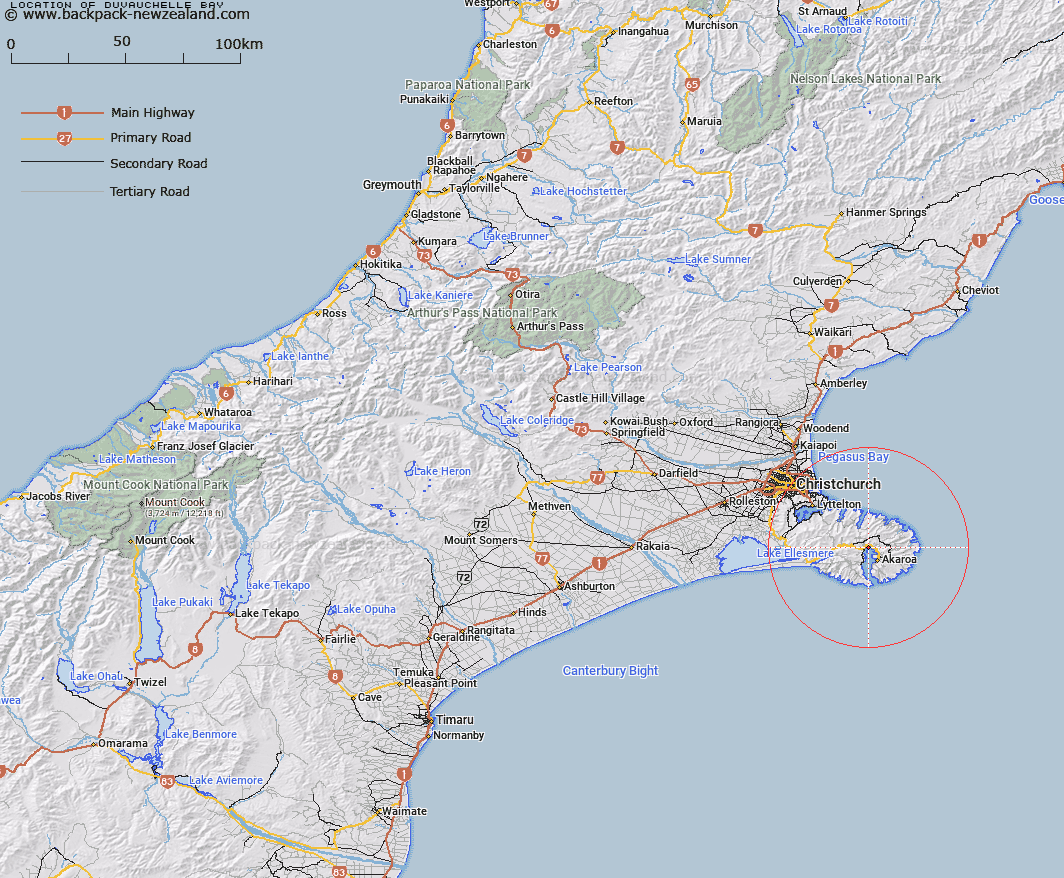
Map showing location of Duvauchelle Bay


LINZ description: The Eastern part of the bay forming the head of Akaroa Harbour. Block XV Pigeon Bay Survey District.
Latitude: -43.755789
Longitude: 172.934412
Northing: 5155248.5
Easting: 1594720
Land District: Canterbury
Feat Type: Bay


Scroll down to see a more detailed road map and below that a topographical map showing the location of Duvauchelle Bay. The road map has been supplied by openstreetmap and the topographical map of Duvauchelle Bay has been supplied by Land Information New Zealand (LINZ).

Yes you can use the top static map for you school/university project or personal website with a link back. Contact me for any commercial use.

Duvauchelle Bay Map New Zealand


New Zealand places in our database
[ A ] [ B ] [ C ] [ D ] [ E ] [ F ] [ G ] [ H ] [ I ] [ J ] [ K ] [ L ] [ M ] [ N ] [ O ] [ P ] [ Q ] [ R ] [ S ] [ T ] [ U ] [ V ] [ W ] [ X ] [ Y ] [ Z ]


Closest 20 Bays to Duvauchelle Bay

Head of Bay ( 0.53km )   Barrys Bay ( 1.51km )   Robinsons Bay ( 1.95km )   French Farm Bay ( 2.95km )   Takamatua Bay ( 3.03km )   Petit Carenage Bay ( 3.69km )   Lushington Bay ( 3.79km )   Akaroa Harbour ( 4.25km )   Tikao Bay ( 4.92km )   Childrens Bay ( 5.48km )   French Bay ( 5.99km )   Glen Bay ( 6.6km )   Anchorage Bay ( 8.14km )   Ohinepaka Bay ( 9.35km )   Holmes Bay ( 9.97km )   Pigeon Bay ( 11.22km )   Mat White Bay ( 11.47km )   Mat Wight Bay ( 11.47km )   Little Akaloa Bay ( 11.68km )   Titoki or Little Tikao Bay ( 11.95km )   Decanter Bay ( 12.52km )   Menzies Bay ( 12.6km )   Lucas Bay ( 12.72km )   Scrubby Bay ( 13.25km )   Stony Bay ( 13.31km )   Stony Beach ( 13.31km )   Manuka Bay ( 13.39km )   Otanerito Bay ( 13.45km )   Okains Bay ( 13.54km )   Squally Bay ( 13.65km )   North West Bay ( 13.66km )   Raupo Bay ( 13.71km )   Whitehead Bay ( 14.05km )   Le Bons Bay ( 14.07km )   Stony Bay ( 14.22km )   Lavericks Bay ( 14.4km )   Sleepy Bay ( 14.52km )   P?hatu/Flea Bay ( 14.63km )   Flea Bay ( 14.63km )   Reef Nook ( 14.68km )