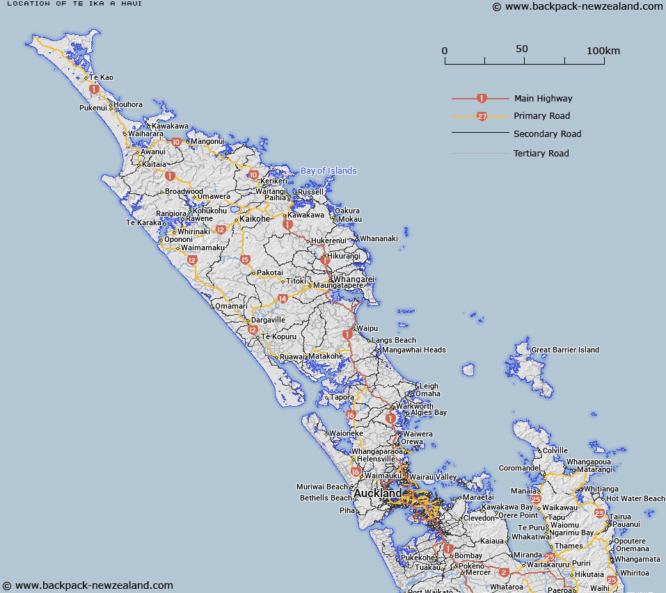
Map showing location of Te Ika-a-Māui


LINZ description: The northern of the two main islands of New Zealand, centred around NZTM 1865000E, 5674000N.
Latitude: -39.042902
Longitude: 176.061884
Northing: 5674000
Easting: 1865000
Land District: North Auckland, South Auckland, Gisborne, Hawke's Bay, Taranaki, Wellington
Feat Type: Island


Scroll down to see a more detailed road map and below that a topographical map showing the location of Te Ika-a-Māui. The road map has been supplied by openstreetmap and the topographical map of Te Ika-a-Māui has been supplied by Land Information New Zealand (LINZ).

Yes you can use the top static map for you school/university project or personal website with a link back. Contact me for any commercial use.

Te Ika-a-Māui Map New Zealand


New Zealand places in our database
[ A ] [ B ] [ C ] [ D ] [ E ] [ F ] [ G ] [ H ] [ I ] [ J ] [ K ] [ L ] [ M ] [ N ] [ O ] [ P ] [ Q ] [ R ] [ S ] [ T ] [ U ] [ V ] [ W ] [ X ] [ Y ] [ Z ]


Closest 20 Islands to Te Ika-a-Māui

Motutaiko Island ( 23.3km )   Te Kapua Island ( 26.28km )   Jones Island ( 27.53km )   Maketu Island ( 28.08km )   Motuopuhi Island ( 31.44km )   Motuwhara Island ( 37.93km )   Ayers Rock ( 47.58km )   Whakapapa Island ( 57.39km )   Hikurangi Island ( 70.12km )   Matekuri Island ( 78.53km )   Patiti Island (Banded Island) ( 91.96km )   Motutawa Island ( 93.91km )   Punaruku Island ( 94.07km )   Moutere Island ( 99.95km )   Otumutu Island ( 101.57km )   Motutorutoru Island ( 101.6km )   Motungarara Island ( 101.79km )   Te Arakoau Island ( 102.17km )   Te Kahaatuwai Island ( 102.58km )   Moutoa Island ( 102.68km )   Te Oneatahu Island ( 103.25km )   Rahui Island ( 103.45km )   Motuwhetero Island ( 103.74km )   Mokoia Island ( 108.84km )   Panirau Island ( 111.25km )   Motumauri Island ( 115.72km )   Motuohiwa Island ( 115.84km )   Pateko Island ( 116.68km )   Karamea (Red Island) ( 120.66km )   Bare ( 120.83km )   Motuokura ( 120.83km )   Corliss Island ( 133.99km )   Opourapa Island ( 135.42km )   Taikorai (Twin Rocks) ( 144.77km )   Bird Island ( 146.05km )   Patawa Island ( 146.52km )   Pataua Island ( 146.52km )   Tuapu Island ( 146.85km )   Motukahu Rocks ( 146.86km )   Ohakana Island ( 147.12km )