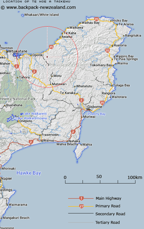
Map showing location of Te Hoe a Taikehu
LINZ description: Hill at height 650m, approximately 20km south-east of Opotiki. Trig. Station "525 Hoiataikahu" (not beaconed) is located on this hill
Latitude: -38.026508
Longitude: 177.490364
Northing: 5781717.1
Easting: 1994198
Land District: Gisborne
Feat Type: Hill
Latitude: -38.026508
Longitude: 177.490364
Northing: 5781717.1
Easting: 1994198
Land District: Gisborne
Feat Type: Hill

Scroll down to see a more detailed road map and below that a topographical map showing the location of Te Hoe a Taikehu. The road map has been supplied by openstreetmap and the topographical map of Te Hoe a Taikehu has been supplied by Land Information New Zealand (LINZ).
Yes you can use the top static map for you school/university project or personal website with a link back. Contact me for any commercial use.
[ A ] [ B ] [ C ] [ D ] [ E ] [ F ] [ G ] [ H ] [ I ] [ J ] [ K ] [ L ] [ M ] [ N ] [ O ] [ P ] [ Q ] [ R ] [ S ] [ T ] [ U ] [ V ] [ W ] [ X ] [ Y ] [ Z ]