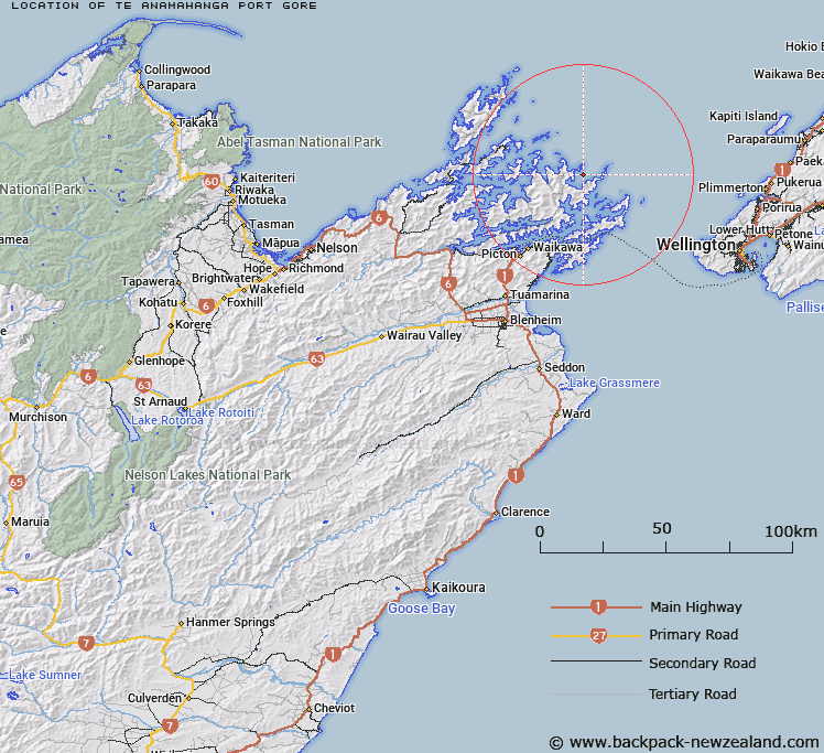
Map showing location of Te Anamāhanga / Port Gore
LINZ description: A bay between Cape Lambert and Cape Jackson adjacent to Cook Strait approximately 3 km northeast of Endeavour Inlet (locality). Feature shown on: NZMS260 Q26 Pt P26 Edition 2 1997; NZTopo50-BP29 036578.
Latitude: -41.024222
Longitude: 174.232278
Northing: 5457822.7
Easting: 1703599.6
Land District: Marlborough
Feat Type: Bay
Latitude: -41.024222
Longitude: 174.232278
Northing: 5457822.7
Easting: 1703599.6
Land District: Marlborough
Feat Type: Bay

Scroll down to see a more detailed road map and below that a topographical map showing the location of Te Anamāhanga / Port Gore. The road map has been supplied by openstreetmap and the topographical map of Te Anamāhanga / Port Gore has been supplied by Land Information New Zealand (LINZ).
Yes you can use the top static map for you school/university project or personal website with a link back. Contact me for any commercial use.
[ A ] [ B ] [ C ] [ D ] [ E ] [ F ] [ G ] [ H ] [ I ] [ J ] [ K ] [ L ] [ M ] [ N ] [ O ] [ P ] [ Q ] [ R ] [ S ] [ T ] [ U ] [ V ] [ W ] [ X ] [ Y ] [ Z ]