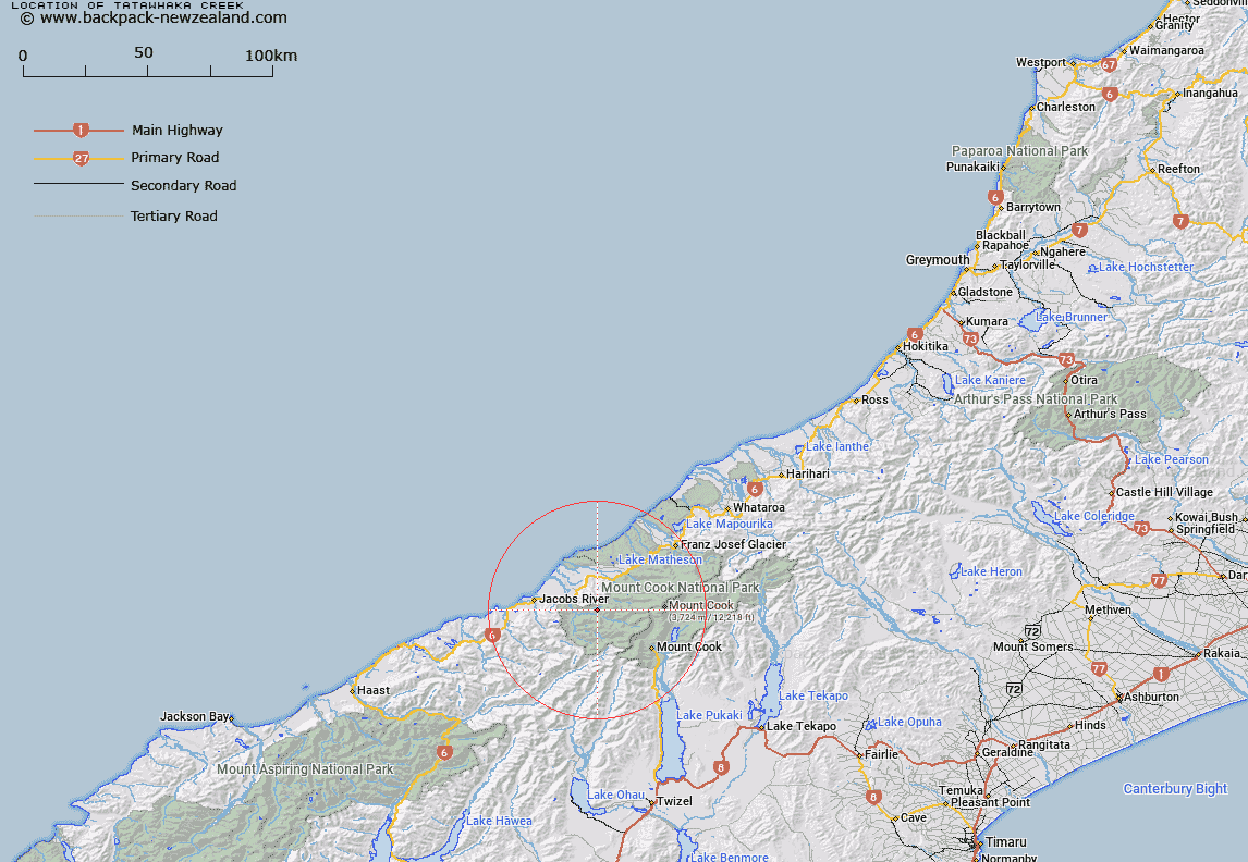
Map showing location of Tātāwhākā Creek


LINZ description: In Westland National Park/Tai Poutini National Park, flowing south-west into Copland River. Topo50 map BX15 - Fox Glacier, source: GR 510 676, confluence: GR 496 664.
Latitude: -43.606739
Longitude: 169.904436
Northing: 5167147.4
Easting: 1350176.5
Land District: Westland
Feat Type: Stream


Scroll down to see a more detailed road map and below that a topographical map showing the location of Tātāwhākā Creek. The road map has been supplied by openstreetmap and the topographical map of Tātāwhākā Creek has been supplied by Land Information New Zealand (LINZ).

Yes you can use the top static map for you school/university project or personal website with a link back. Contact me for any commercial use.

Tātāwhākā Creek Map New Zealand


New Zealand places in our database
[ A ] [ B ] [ C ] [ D ] [ E ] [ F ] [ G ] [ H ] [ I ] [ J ] [ K ] [ L ] [ M ] [ N ] [ O ] [ P ] [ Q ] [ R ] [ S ] [ T ] [ U ] [ V ] [ W ] [ X ] [ Y ] [ Z ]


Closest 20 Streams to Tātāwhākā Creek

Palaver Creek ( 1.5km )   McPhee Creek ( 1.81km )   Architect Creek ( 1.84km )   Open Creek ( 2.21km )   Chlorite Creek ( 2.81km )   Therma Creek ( 2.81km )   Copland River ( 3.04km )   Vickers Creek ( 3.19km )   K?marupeka Creek ( 3.2km )   Shiels Creek ( 3.46km )   Foam Creek ( 4.03km )   Sparkling Creek ( 4.14km )   Katau Creek ( 4.26km )   Creamy Creek ( 4.75km )   Crag Creek ( 5.35km )   Splinter Creek ( 6.22km )   Ruera River ( 6.25km )   Regina Creek ( 6.41km )   Darkwater Stream ( 7.25km )   Scott Creek ( 7.55km )   Twain River ( 7.62km )   Douglas River ( 7.62km )   Scotts Creek ( 7.79km )   Bluewater Creek ( 7.85km )   Rough Creek ( 8.13km )   Border Creek ( 8.34km )   Harkells Creek ( 8.51km )   McTaggart Creek ( 9.06km )   McBain Creek ( 9.28km )   Bunker Creek ( 9.43km )   Havelock Creek ( 9.48km )   Purcell Creek ( 9.73km )   Jungle Creek ( 9.81km )   Driblet Creek ( 9.82km )   Ohinetamatea River ( 9.84km )   Curly Creek ( 9.92km )   Niblick Creek ( 10.05km )   Maimai Creek ( 10.17km )   Hobson Creek ( 10.29km )   Strauchon River ( 10.32km )