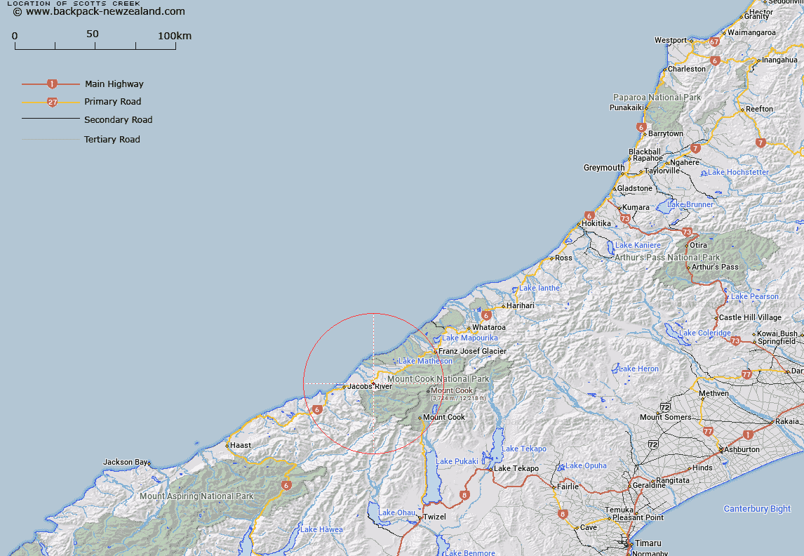
Map showing location of Scotts Creek


LINZ description: Left bank tributary of Border Creek, joining Border Creek just east of Main Highway 6. Block VI Karangarua Survey District.
Latitude: -43.551866
Longitude: 169.844375
Northing: 5173059.5
Easting: 1345097.4
Land District: Westland
Feat Type: Stream


Scroll down to see a more detailed road map and below that a topographical map showing the location of Scotts Creek. The road map has been supplied by openstreetmap and the topographical map of Scotts Creek has been supplied by Land Information New Zealand (LINZ).

Yes you can use the top static map for you school/university project or personal website with a link back. Contact me for any commercial use.

Scotts Creek Map New Zealand


New Zealand places in our database
[ A ] [ B ] [ C ] [ D ] [ E ] [ F ] [ G ] [ H ] [ I ] [ J ] [ K ] [ L ] [ M ] [ N ] [ O ] [ P ] [ Q ] [ R ] [ S ] [ T ] [ U ] [ V ] [ W ] [ X ] [ Y ] [ Z ]


Closest 20 Streams to Scotts Creek

Border Creek ( 0.86km )   Hobson Creek ( 2.58km )   Havelock Creek ( 3.22km )   Rough Creek ( 3.44km )   Ohinetamatea River (Saltwater River) ( 4.84km )   Chlorite Creek ( 5.35km )   K?marupeka Creek ( 5.52km )   Katau Creek ( 5.66km )   Maimai Creek ( 5.69km )   Black Creek ( 6.1km )   Ohinetamatea River ( 6.43km )   McPhee Creek ( 6.72km )   Copland River ( 6.84km )   Architect Creek ( 6.97km )   T?t?wh?k? Creek ( 7.79km )   McTaggart Creek ( 7.98km )   Vickers Creek ( 8.37km )   Nicholson Creek ( 8.97km )   Bullock Creek ( 9.15km )   Harkells Creek ( 9.26km )   Palaver Creek ( 9.29km )   Bullock Creek ( 9.76km )   Driblet Creek ( 9.89km )   Open Creek ( 9.9km )   Hermit Creek ( 10.22km )   Therma Creek ( 10.37km )   Cook River/Weheka ( 10.85km )   Cook River ( 10.85km )   Boyds Creek ( 10.93km )   Hunt Creek ( 10.98km )   Gordon Creek ( 10.99km )   Shiels Creek ( 11km )   McBain Creek ( 11.03km )   Karangarua River ( 11.11km )   Purcell Creek ( 11.26km )   Manakaiaua River ( 11.36km )   Scotchmans Creek ( 11.39km )   Gordon Creek ( 11.47km )   Bunker Creek ( 11.53km )   Ribbonwood Creek ( 11.58km )