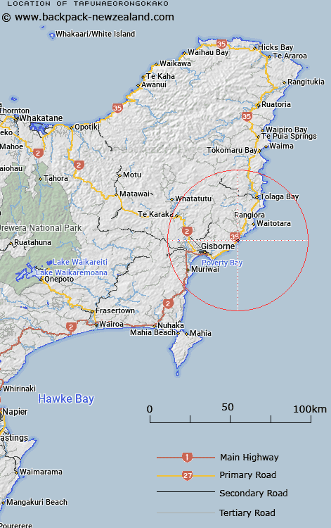
Map showing location of Tapuwaeorongokako


LINZ description: Approximately 1km north from Poriokonohi Point.
Latitude: -38.596139
Longitude: 178.199261
Northing: 5715200
Easting: 2052900
Land District: Gisborne
Feat Type: Point


Scroll down to see a more detailed road map and below that a topographical map showing the location of Tapuwaeorongokako. The road map has been supplied by openstreetmap and the topographical map of Tapuwaeorongokako has been supplied by Land Information New Zealand (LINZ).

Yes you can use the top static map for you school/university project or personal website with a link back. Contact me for any commercial use.

Tapuwaeorongokako Map New Zealand


New Zealand places in our database
[ A ] [ B ] [ C ] [ D ] [ E ] [ F ] [ G ] [ H ] [ I ] [ J ] [ K ] [ L ] [ M ] [ N ] [ O ] [ P ] [ Q ] [ R ] [ S ] [ T ] [ U ] [ V ] [ W ] [ X ] [ Y ] [ Z ]


Closest 20 Points to Tapuwaeorongokako

Pariokonohi Point ( 1.02km )   Pariokanoki Point ( 1.02km )   Te Ana Paikea ( 3.92km )   Te Anaopaikea Point ( 3.92km )   Turihaua Point ( 4.4km )   Tatapouri Point ( 7.71km )   Gable End Foreland ( 11.03km )   Makarori Point ( 11.33km )   Makorori Point ( 11.33km )   Tuahina Point ( 16.79km )   Tuaheni Point ( 16.79km )   Young Nicks Head (Te Kuri) ( 26.62km )   Te Karaka Point ( 29.29km )   Pairau Point ( 31.56km )   Paerau Point ( 31.56km )   Mapiri ( 34.6km )   Mapere ( 34.6km )   Marau Point ( 37.16km )   Whareongaonga ( 38.09km )   Mawhai Point ( 48.84km )   Te Ariuru Point ( 55.54km )   Kotonui Point ( 55.78km )   Koutunui Point ( 55.78km )   Auroa Point ( 58.72km )   Kahutara Point ( 58.9km )   Putiki Point ( 59.42km )   Tuahuru Point ( 59.78km )   Mokotahi ( 61.85km )   Koatunui Head ( 62.4km )   Koutunui Head ( 62.4km )   Pokurakura Point ( 63.02km )   Whakatakahe Head ( 63.7km )   Te Kereu Point ( 64.12km )   Te Heruotaraia Point ( 68.06km )   Te Heru o Taraia Point ( 68.06km )   Otamarauiri Point ( 68.3km )   Otamarauri Point ( 68.3km )   Long Point (Taramahiti Point) ( 70.59km )   Upukuotangata Point ( 71.16km )   Waikahawai Point ( 72.37km )