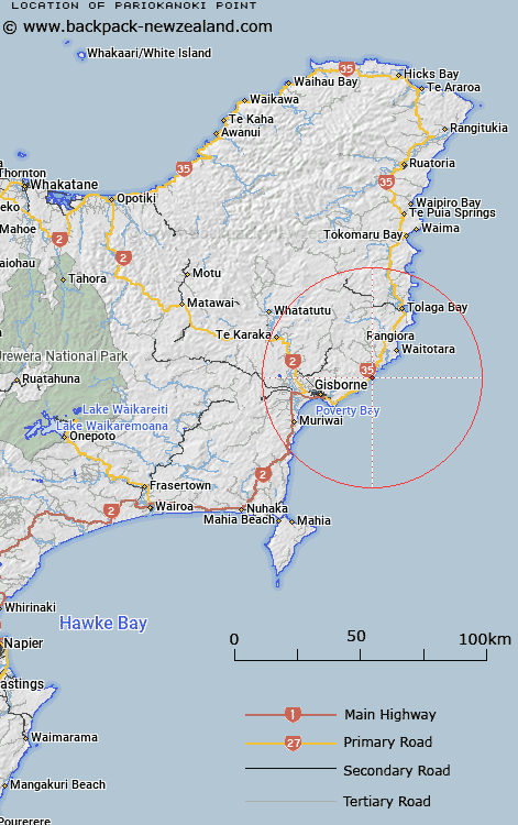
Map showing location of Pariokanoki Point


LINZ description: Located 6km north-east of Tatapouri Point, where Pouawa River exits to the sea.
Latitude: -38.605216
Longitude: 178.197623
Northing: 5714200
Easting: 2052700
Land District: Gisborne
Feat Type: Point


Scroll down to see a more detailed road map and below that a topographical map showing the location of Pariokanoki Point. The road map has been supplied by openstreetmap and the topographical map of Pariokanoki Point has been supplied by Land Information New Zealand (LINZ).

Yes you can use the top static map for you school/university project or personal website with a link back. Contact me for any commercial use.

Pariokanoki Point Map New Zealand


New Zealand places in our database
[ A ] [ B ] [ C ] [ D ] [ E ] [ F ] [ G ] [ H ] [ I ] [ J ] [ K ] [ L ] [ M ] [ N ] [ O ] [ P ] [ Q ] [ R ] [ S ] [ T ] [ U ] [ V ] [ W ] [ X ] [ Y ] [ Z ]


Closest 20 Points to Pariokanoki Point

Tapuwae-o-rangokoko ( 1.02km )   Tapuwaeorongokako ( 1.02km )   Turihaua Point ( 3.51km )   Te Anaopaikea Point ( 4.76km )   Te Ana Paikea ( 4.76km )   Tatapouri Point ( 6.83km )   Makarori Point ( 10.55km )   Makorori Point ( 10.55km )   Gable End Foreland ( 11.84km )   Tuaheni Point ( 15.96km )   Tuahina Point ( 15.96km )   Young Nicks Head (Te Kuri) ( 25.85km )   Te Karaka Point ( 30.28km )   Pairau Point ( 32.55km )   Paerau Point ( 32.55km )   Mapere ( 33.78km )   Mapiri ( 33.78km )   Whareongaonga ( 37.22km )   Marau Point ( 38.15km )   Mawhai Point ( 49.85km )   Te Ariuru Point ( 56.55km )   Kotonui Point ( 56.79km )   Koutunui Point ( 56.79km )   Auroa Point ( 57.73km )   Kahutara Point ( 57.89km )   Putiki Point ( 58.43km )   Tuahuru Point ( 58.8km )   Mokotahi ( 60.89km )   Whakatakahe Head ( 62.74km )   Te Kereu Point ( 63.16km )   Koatunui Head ( 63.41km )   Koutunui Head ( 63.41km )   Pokurakura Point ( 64.03km )   Te Heruotaraia Point ( 67.1km )   Te Heru o Taraia Point ( 67.1km )   Otamarauiri Point ( 69.32km )   Otamarauri Point ( 69.32km )   Long Point (Taramahiti Point) ( 69.63km )   Upukuotangata Point ( 70.2km )   Waikakawai Point ( 73.38km )