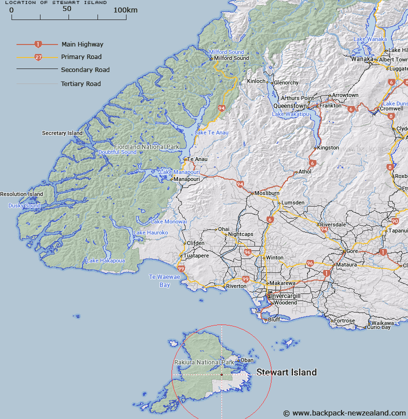
Map showing location of Stewart Island


LINZ description: Feature shown on: NZMS265/2; Infomap 346-02 Te Wai Pounamu Edition 1 1995; NZTopo50-CJ09 199826
Latitude: -47.000818
Longitude: 167.999849
Northing: 4782600
Easting: 1219900
Land District: Southland
Feat Type: Island


Scroll down to see a more detailed road map and below that a topographical map showing the location of Stewart Island. The road map has been supplied by openstreetmap and the topographical map of Stewart Island has been supplied by Land Information New Zealand (LINZ).

Yes you can use the top static map for you school/university project or personal website with a link back. Contact me for any commercial use.

Stewart Island Map New Zealand


New Zealand places in our database
[ A ] [ B ] [ C ] [ D ] [ E ] [ F ] [ G ] [ H ] [ I ] [ J ] [ K ] [ L ] [ M ] [ N ] [ O ] [ P ] [ Q ] [ R ] [ S ] [ T ] [ U ] [ V ] [ W ] [ X ] [ Y ] [ Z ]


Closest 20 Islands to Stewart Island

Blue Gum Island ( 10.74km )   Kidney Fern Island ( 11km )   Mudflat Island ( 11.02km )   Tamihau Island ( 11.05km )   Tommy Island ( 11.07km )   Bravo Island ( 11.21km )   Refuge Island ( 11.27km )   Crayfish Island ( 11.51km )   Goat Island ( 11.79km )   Dirty Island ( 11.8km )   Groper Island ( 12.24km )   Burial Island ( 12.46km )   Ulva Island ( 12.51km )   Boat Passage Islands ( 12.77km )   Faith Hope and Charity Group ( 13.43km )   Iona Island ( 13.96km )   White Rock ( 14.58km )   Cow Island ( 14.88km )   Native Island ( 15.08km )   Thomson Nugget ( 15.23km )   Old Mill Nugget ( 15.49km )   Kopeka Island ( 15.85km )   Chew Tobacco Island ( 16.03km )   Pihore Island ( 16.03km )   Bragg Nugget ( 16.23km )   Pukaweka Island ( 17.67km )   Weka Island ( 17.67km )   Owen Island (Horomamae) ( 17.92km )   Horomamae Island (Owen) ( 17.92km )   Horomamae/Owen Island ( 17.92km )   Horseshoe Nugget ( 18.28km )   Black Rock ( 18.48km )   Tia Island (Entrance) ( 18.52km )   Nathans Island ( 19.04km )   Pukawahakura Island ( 19.05km )   Rukawahakura Island ( 19.05km )   Pohomatakiarehua Island ( 19.25km )   Pomatakiarehua Island ( 19.25km )   Potuatua Island ( 19.4km )   Pohotuatua Island ( 19.4km )