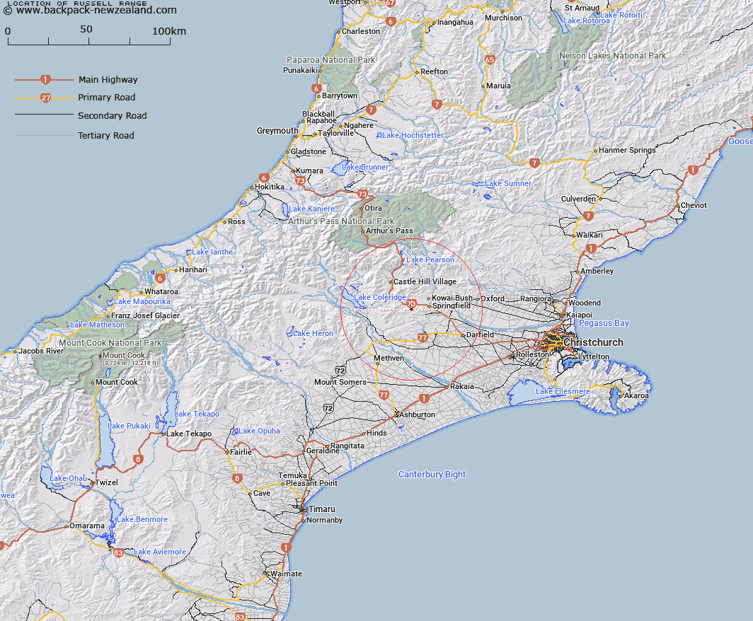
Map showing location of Russell Range


LINZ description: Range of hills South-west of Springfield. Range extending from Trig. H (Geodetic Code AA4R) through "Russell Peak" [Trig. I (Geodetic Code B2PQ)] to Trig F No 2 (Geodetic Code B2PR). Blocks X, XI, XIII, XIV and XV Kowai Survey District.
Latitude: -43.351468
Longitude: 171.82987
Northing: 5199489.3
Easting: 1505169.7
Land District: Canterbury
Feat Type: Range


Scroll down to see a more detailed road map and below that a topographical map showing the location of Russell Range. The road map has been supplied by openstreetmap and the topographical map of Russell Range has been supplied by Land Information New Zealand (LINZ).

Yes you can use the top static map for you school/university project or personal website with a link back. Contact me for any commercial use.

Russell Range Map New Zealand


New Zealand places in our database
[ A ] [ B ] [ C ] [ D ] [ E ] [ F ] [ G ] [ H ] [ I ] [ J ] [ K ] [ L ] [ M ] [ N ] [ O ] [ P ] [ Q ] [ R ] [ S ] [ T ] [ U ] [ V ] [ W ] [ X ] [ Y ] [ Z ]


Closest 20 Ranges to Russell Range

Russell Range ( 0km )   Lady Barker Range ( 10.04km )   Big Ben Range ( 10.11km )   Torlesse Range ( 12.59km )   Rockwood Range ( 15.96km )   Craigieburn Range ( 23.71km )   Clay Range ( 27.68km )   Mount Hutt Range ( 27.71km )   Cottons Sheep Range ( 30.21km )   Pudding Hill Range ( 33.03km )   Grey Range ( 33.8km )   Black Hill Range ( 35.55km )   Alford Range ( 38.27km )   Kingsdown Hills ( 38.55km )   Old Man Range ( 42.84km )   Birdwood Range ( 43.22km )   Taylor Range ( 43.76km )   Tobacco Range ( 44.3km )   Black Range ( 44.36km )   Winterslow Range ( 44.56km )   Mount Somers Range ( 46.36km )   Pancake Range ( 47.13km )   Polar Range ( 47.92km )   Savannah Range ( 48.62km )   Palmer Range ( 48.81km )   Longman Range ( 50.46km )   Manuka Range ( 51.17km )   Puketeraki Range ( 51.63km )   Poulter Range ( 53.08km )   Cascade Range ( 53.2km )   Okuku Range ( 54.69km )   Rolleston Range ( 54.73km )   Shaler Range ( 55.35km )   Clent Hills ( 56.06km )   The Candlesticks ( 56.51km )   Gawler Downs ( 58.07km )   McLaurin Range ( 58.8km )   Maclaurin Ridge ( 58.8km )   Aicken Range ( 59.29km )   Snow Cup Range ( 59.37km )