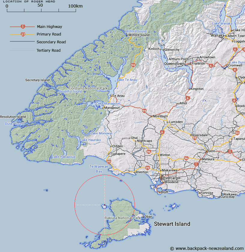
Map showing location of Roger Head


LINZ description: On Codfish Island
Latitude: -46.752157
Longitude: 167.63792
Northing: 4808400
Easting: 1190500
Land District: Southland
Feat Type: Point


Scroll down to see a more detailed road map and below that a topographical map showing the location of Roger Head. The road map has been supplied by openstreetmap and the topographical map of Roger Head has been supplied by Land Information New Zealand (LINZ).

Yes you can use the top static map for you school/university project or personal website with a link back. Contact me for any commercial use.

Roger Head Map New Zealand


New Zealand places in our database
[ A ] [ B ] [ C ] [ D ] [ E ] [ F ] [ G ] [ H ] [ I ] [ J ] [ K ] [ L ] [ M ] [ N ] [ O ] [ P ] [ Q ] [ R ] [ S ] [ T ] [ U ] [ V ] [ W ] [ X ] [ Y ] [ Z ]


Closest 20 Points to Roger Head

North Red Head ( 5.39km )   McArthurs Head ( 7.42km )   Putatara Point ( 8.16km )   Richards Point ( 11.01km )   Cave Point ( 13.47km )   Mason Head ( 15.96km )   Black Rock Point ( 19.14km )   Moonlight Point ( 20.25km )   White Rock Point ( 22.4km )   Lucky Point ( 23.83km )   Saddle Point ( 25.98km )   Garden Point ( 28.04km )   Gull Rock Point ( 30.55km )   Ogles Point ( 32.73km )   North Arm Point ( 33.05km )   Dynamite Point ( 34.22km )   Harry West Point ( 34.51km )   Harry West Bay ( 34.51km )   Allans Point ( 36.52km )   Peters Point ( 36.7km )   Prices Point ( 37.21km )   Kaipipi Point ( 37.36km )   Red Head Point ( 38.1km )   Patere Point ( 38.1km )   Weather Point ( 38.1km )   South Red Head Point ( 38.1km )   Trumpeter Point ( 38.8km )   Bobs Point ( 38.96km )   Cow and Calf Point ( 39.21km )   Mamaku Point ( 40.4km )   Hicks Point ( 40.77km )   Louis Point ( 40.82km )   Bull Point ( 41km )   Peterson Point ( 41.2km )   Horseshoe Point ( 41.32km )   Macrae Point ( 41.32km )   Lonnekers Point ( 41.44km )   Bragg Point ( 41.5km )   Fly Point ( 41.72km )   Wakaputa Point ( 41.74km )