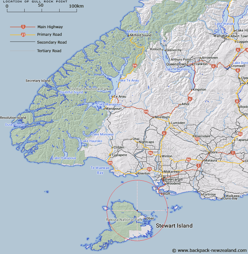
Map showing location of Gull Rock Point


LINZ description: Point adjacent to Gull Rock Trig. (Geodetic Code A02A). North-east coast of Stewart Island. Anglem Survey District.
Latitude: -46.799737
Longitude: 168.032974
Northing: 4805100
Easting: 1221000
Land District: Southland
Feat Type: Point


Scroll down to see a more detailed road map and below that a topographical map showing the location of Gull Rock Point. The road map has been supplied by openstreetmap and the topographical map of Gull Rock Point has been supplied by Land Information New Zealand (LINZ).

Yes you can use the top static map for you school/university project or personal website with a link back. Contact me for any commercial use.

Gull Rock Point Map New Zealand


New Zealand places in our database
[ A ] [ B ] [ C ] [ D ] [ E ] [ F ] [ G ] [ H ] [ I ] [ J ] [ K ] [ L ] [ M ] [ N ] [ O ] [ P ] [ Q ] [ R ] [ S ] [ T ] [ U ] [ V ] [ W ] [ X ] [ Y ] [ Z ]


Closest 20 Points to Gull Rock Point

Garden Point ( 3.55km )   Peters Point ( 7.58km )   Bobs Point ( 9.44km )   Saddle Point ( 9.71km )   Mamaku Point ( 10.9km )   North Arm Point ( 11.53km )   Lucky Point ( 12.26km )   Allans Point ( 12.32km )   Horseshoe Point ( 12.4km )   Dynamite Point ( 12.46km )   Kaipipi Point ( 12.52km )   Louis Point ( 12.73km )   Hicks Point ( 12.96km )   Bragg Point ( 13.09km )   Cow and Calf Point ( 13.12km )   Prices Point ( 13.32km )   Moonlight Point ( 13.43km )   Peterson Point ( 13.57km )   Macrae Point ( 13.61km )   Lonnekers Point ( 13.67km )   Wast Point ( 13.77km )   Fly Point ( 13.77km )   White Rock Point ( 13.86km )   Harry West Bay ( 13.99km )   Harry West Point ( 13.99km )   Fisherman Point ( 14.08km )   Ackers Point ( 14.61km )   Ringaringa Point ( 14.94km )   Flagstaff Point ( 15.9km )   Ogles Point ( 16.45km )   Trumpeter Point ( 16.49km )   Bull Point ( 17.76km )   Schoolhouse Point ( 17.86km )   Chasland Point ( 17.86km )   High Point ( 17.88km )   Black Rock Point ( 17.94km )   Bullers Point ( 18.16km )   Bullers Point (Anglem) ( 18.17km )   Fifes Point ( 18.27km )   Burnt Point ( 18.65km )