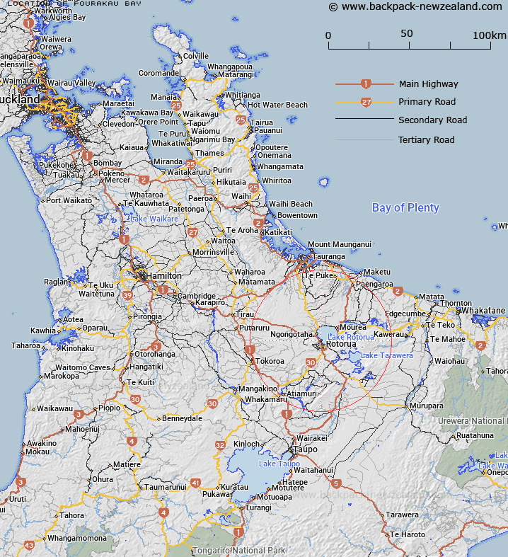
Map showing location of Pourākau Bay
LINZ description: Located north of Utuhina Stream and south of Kawaha Point in Lake Rotorua
Latitude: -38.112871
Longitude: 176.24042
Northing: 5776700
Easting: 1884100
Land District: South Auckland
Feat Type: Bay
Latitude: -38.112871
Longitude: 176.24042
Northing: 5776700
Easting: 1884100
Land District: South Auckland
Feat Type: Bay

Scroll down to see a more detailed road map and below that a topographical map showing the location of Pourākau Bay. The road map has been supplied by openstreetmap and the topographical map of Pourākau Bay has been supplied by Land Information New Zealand (LINZ).
Yes you can use the top static map for you school/university project or personal website with a link back. Contact me for any commercial use.
[ A ] [ B ] [ C ] [ D ] [ E ] [ F ] [ G ] [ H ] [ I ] [ J ] [ K ] [ L ] [ M ] [ N ] [ O ] [ P ] [ Q ] [ R ] [ S ] [ T ] [ U ] [ V ] [ W ] [ X ] [ Y ] [ Z ]