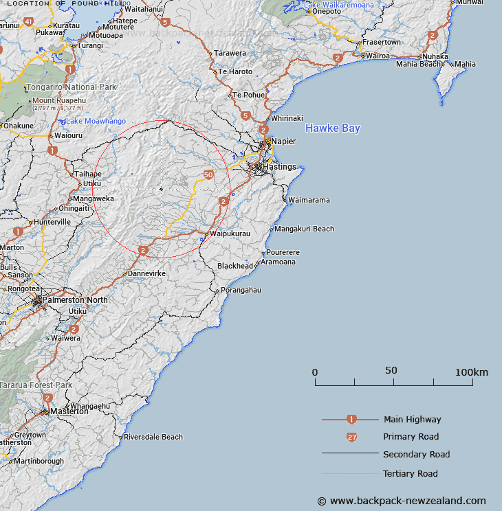
Map showing location of Pound Hill


LINZ description: Hill approximately 120 chains south-west of Trig. Marked I (3,307 ft). Wakarara Survey District.
Latitude: -39.755346
Longitude: 176.296739
Northing: 5594196.8
Easting: 1882439
Land District: Hawke's Bay
Feat Type: Hill


Scroll down to see a more detailed road map and below that a topographical map showing the location of Pound Hill. The road map has been supplied by openstreetmap and the topographical map of Pound Hill has been supplied by Land Information New Zealand (LINZ).

Yes you can use the top static map for you school/university project or personal website with a link back. Contact me for any commercial use.

Pound Hill Map New Zealand


New Zealand places in our database
[ A ] [ B ] [ C ] [ D ] [ E ] [ F ] [ G ] [ H ] [ I ] [ J ] [ K ] [ L ] [ M ] [ N ] [ O ] [ P ] [ Q ] [ R ] [ S ] [ T ] [ U ] [ V ] [ W ] [ X ] [ Y ] [ Z ]


Closest 20 Hills to Pound Hill

Crag Peak ( 2.47km )   The Tump Peak ( 2.66km )   Sugar Loaf Peak ( 2.95km )   Bald Hill ( 4.85km )   Breakheart Peak ( 9.92km )   Rocky Knoll ( 10.01km )   Patiki ( 10.23km )   Maropea ( 10.37km )   Orupu ( 10.87km )   Te Atua Mahuru ( 11.14km )   Maroparea ( 11.76km )   Ina Rock ( 11.94km )   Tupari ( 12.33km )   Remutupo ( 12.72km )   Mount Mary ( 12.93km )   Folgers Hill ( 13.04km )   Piopio ( 13.45km )   Three Johns Peak ( 13.58km )   Rangiwhakamataku ( 13.61km )   Waikamaka ( 14.31km )   Piringa ( 15.11km )   Puketaramea ( 15.23km )   Rangioteatua ( 15.62km )   Rongotea ( 15.74km )   Three Fingers ( 15.77km )   Potae ( 16.35km )   Ohawai ( 17.81km )   Hikurangi ( 18.15km )   Makirikiri ( 18.55km )   Ikawetea ( 18.94km )   Te Rakaunuiakura ( 19.22km )   Tauwharepokoru ( 19.61km )   Iron Peg ( 19.82km )   Titapu ( 20.08km )   Pukenui ( 20.12km )   Wooden Peg ( 20.45km )   Tikorangi ( 20.67km )   Rakautaonga ( 20.81km )   Lookout Hill ( 20.84km )   Ben Lomond ( 21.16km )