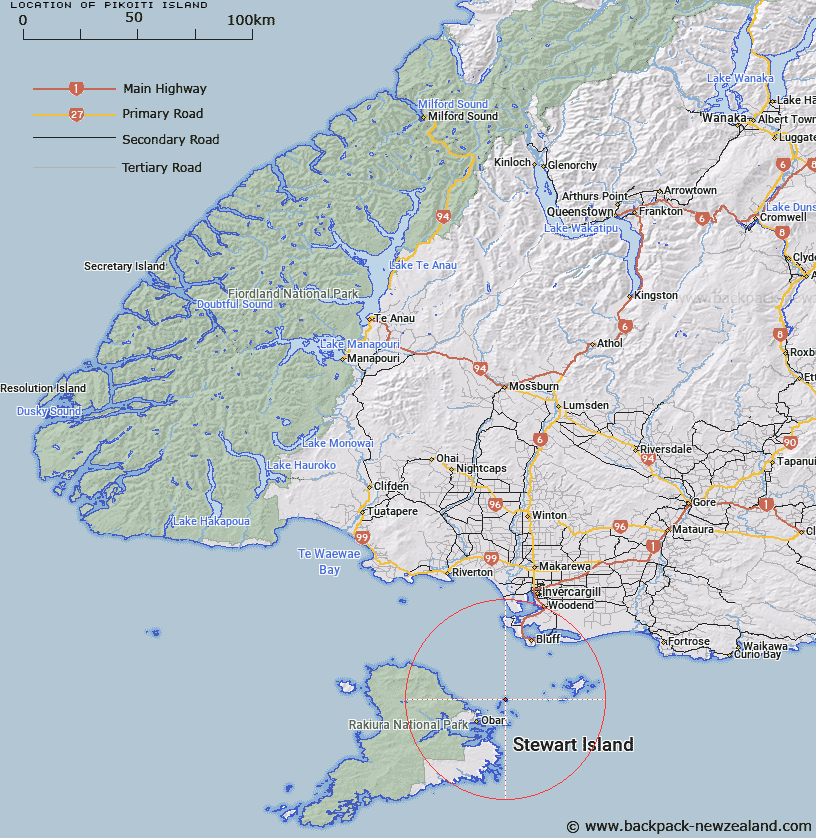
Map showing location of Pikoiti Island


LINZ description: Confirmed name for a small island, 12km north-east of Halfmoon Bay (Oban) and included in the Titi/Muttonbird Islands, Foveaux Strait. Currently shown as North Island on mapping.
Latitude: -46.816453
Longitude: 168.239369
Northing: 4804219.7
Easting: 1236859
Land District: Southland
Feat Type: Island


Scroll down to see a more detailed road map and below that a topographical map showing the location of Pikoiti Island. The road map has been supplied by openstreetmap and the topographical map of Pikoiti Island has been supplied by Land Information New Zealand (LINZ).

Yes you can use the top static map for you school/university project or personal website with a link back. Contact me for any commercial use.

Pikoiti Island Map New Zealand


New Zealand places in our database
[ A ] [ B ] [ C ] [ D ] [ E ] [ F ] [ G ] [ H ] [ I ] [ J ] [ K ] [ L ] [ M ] [ N ] [ O ] [ P ] [ Q ] [ R ] [ S ] [ T ] [ U ] [ V ] [ W ] [ X ] [ Y ] [ Z ]


Closest 20 Islands to Pikoiti Island

Pikoiti Island ( 0km )   Pikomamaku Island ( 0km )   North Island ( 0km )   Zero Rock ( 0.33km )   Womens Island ( 0.91km )   Motunui/Edwards Island ( 2.79km )   Edwards Island ( 2.79km )   Jacky Lee Island ( 4.11km )   Pukeokaoka Island ( 4.11km )   Maria Higgins Rock ( 4.14km )   Herekopare Island (Te Marama) ( 5.64km )   Te Marama Island ( 5.64km )   Bunker Islets ( 5.94km )   Fish Rock ( 6.96km )   Kanetetoe Island ( 7.94km )   Nathans Island ( 8.85km )   Horseshoe Nugget ( 9.3km )   Bench Island ( 10.3km )   The Haystacks ( 11km )   Bragg Nugget ( 11.19km )   Fife Rock ( 11.53km )   Old Mill Nugget ( 11.93km )   Thomson Nugget ( 12.18km )   Half Passage Rock ( 12.55km )   Native Island ( 12.73km )   Iona Island ( 13.45km )   Faith Hope and Charity Group ( 14.02km )   Bird Island ( 15.04km )   Ulva Island ( 15.35km )   Cow Island ( 15.42km )   Burial Island ( 15.7km )   Dirty Island ( 15.92km )   Tamihau Island ( 16.46km )   Hazelburgh Group ( 16.84km )   Groper Island ( 16.87km )   Crayfish Island ( 17.03km )   Refuge Island ( 17.03km )   Goat Island ( 17.35km )   Tommy Island ( 17.47km )   Boat Passage Islands ( 17.54km )