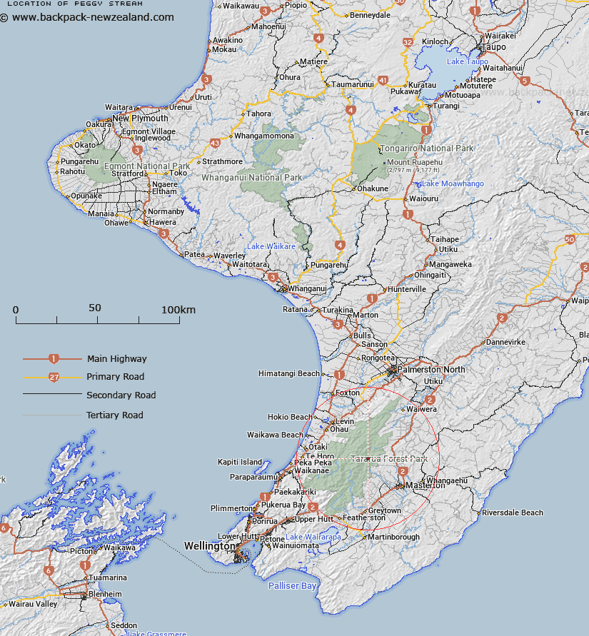
Map showing location of Peggy Stream


LINZ description: Flowing easterly from Peggys Peak to Waingawa River. Mikimiki Survey District.
Latitude: -40.806742
Longitude: 175.479278
Northing: 5479738.1
Easting: 1809128.6
Land District: Wellington
Feat Type: Stream


Scroll down to see a more detailed road map and below that a topographical map showing the location of Peggy Stream. The road map has been supplied by openstreetmap and the topographical map of Peggy Stream has been supplied by Land Information New Zealand (LINZ).

Yes you can use the top static map for you school/university project or personal website with a link back. Contact me for any commercial use.

Peggy Stream Map New Zealand


New Zealand places in our database
[ A ] [ B ] [ C ] [ D ] [ E ] [ F ] [ G ] [ H ] [ I ] [ J ] [ K ] [ L ] [ M ] [ N ] [ O ] [ P ] [ Q ] [ R ] [ S ] [ T ] [ U ] [ V ] [ W ] [ X ] [ Y ] [ Z ]


Closest 20 Streams to Peggy Stream

Peggy Stream ( 0km )   North Mitre Stream ( 1.26km )   Donald Stream ( 1.65km )   South Mitre Stream ( 2.51km )   Mikimiki Stream ( 3.03km )   Stoney Creek ( 3.14km )   Cow Creek ( 3.65km )   Baldy Creek ( 3.76km )   Waingawa River ( 4.61km )   Cleft Creek ( 4.98km )   Reef Creek ( 5.14km )   Dorset Creek ( 5.54km )   Blake Stream ( 5.7km )   Arete Stream ( 6.15km )   Fall Stream ( 6.55km )   Kiriwhakapapa Stream ( 6.7km )   Atiwhakatu Stream ( 7.45km )   Angle Knob Creek ( 7.78km )   Park River ( 8.08km )   Thompson Creek ( 8.19km )   Te Mara Stream ( 8.7km )   Holdsworth Creek ( 9.07km )   Francis Creek ( 9.12km )   Staircase Creek ( 9.12km )   Wakamoekau Creek ( 9.14km )   Brockett Creek ( 9.2km )   Collie Creek ( 9.51km )   Hart Creek ( 9.51km )   Crawford Creek ( 9.6km )   Puketoro Stream ( 9.89km )   Mangahao River ( 10.23km )   Black Creek ( 10.32km )   Waipoua River ( 10.51km )   Kelleher Creek ( 10.8km )   Kelliher Creek ( 10.8km )   Ruapae Stream ( 11.13km )   Gentle Annie Creek ( 11.34km )   Chamberlain Creek ( 11.35km )   Isabelle Creek ( 11.79km )   Butchers Creek ( 11.8km )