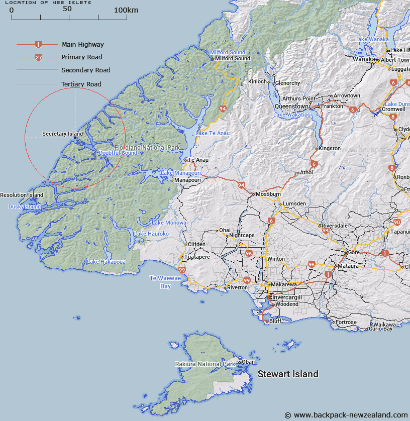
Map showing location of Nee Islets


LINZ description: Group of approximately seven small islands at the mouth of Doubtful Sound.
Latitude: -45.249661
Longitude: 166.871242
Northing: 4971012.7
Easting: 1119070.6
Land District: Southland
Feat Type: Island


Scroll down to see a more detailed road map and below that a topographical map showing the location of Nee Islets. The road map has been supplied by openstreetmap and the topographical map of Nee Islets has been supplied by Land Information New Zealand (LINZ).

Yes you can use the top static map for you school/university project or personal website with a link back. Contact me for any commercial use.

Nee Islets Map New Zealand


New Zealand places in our database
[ A ] [ B ] [ C ] [ D ] [ E ] [ F ] [ G ] [ H ] [ I ] [ J ] [ K ] [ L ] [ M ] [ N ] [ O ] [ P ] [ Q ] [ R ] [ S ] [ T ] [ U ] [ V ] [ W ] [ X ] [ Y ] [ Z ]


Closest 20 Islands to Nee Islets

Nea Island ( 0.3km )   Nee Island ( 0.3km )   Shelter Islands ( 2.56km )   Hares Ears ( 3.27km )   Secretary Island ( 4.99km )   Bauza Island ( 5.68km )   Utah Island ( 6.07km )   Omapere Rock ( 11.48km )   Seymour Island ( 12.37km )   Matai Island ( 14.25km )   Towing Head Islands ( 19.35km )   Entrance Island ( 20.28km )   Macdonell Island ( 20.98km )   Fergusson Island ( 24.16km )   Catherine Island ( 24.71km )   Fanny Island ( 24.82km )   Lloyd Island ( 25.16km )   Eleanor Island ( 27.16km )   Elizabeth Island ( 27.73km )   Rolla Island ( 29.45km )   Styles Island ( 33.63km )   John Islands ( 35.54km )   Harbour Islands ( 37.75km )   Entry Island ( 40.62km )   Breaksea Island ( 40.94km )   Hawea Island ( 41.95km )   H?wea Island ( 41.95km )   Gilbert Islands ( 41.97km )   Wairaki Island ( 42.29km )   Oke Island ( 43.09km )   Koinga Island ( 45.73km )   Resolution Island ( 50.68km )   Houseroof Rock ( 50.82km )   Girlies Island ( 53km )   Cooper Island ( 53.81km )   Shag Islands ( 54.24km )   Front Islands ( 55.62km )   Pomona Island ( 55.84km )   Baybles Island ( 56.44km )   Pigeon Island ( 56.58km )