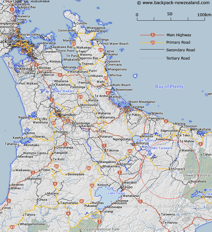
Map showing location of Murupara


LINZ description: Township located at the southern end of a plain of the Rangitaiki River, 40km South of Kawerau and 53km South-east of Rotorua. Galatea Survey District.
Latitude: -38.456408
Longitude: 176.704782
Northing: 5737038.1
Easting: 1923295.2
Land District: South Auckland
Feat Type: Town


Scroll down to see a more detailed road map and below that a topographical map showing the location of Murupara. The road map has been supplied by openstreetmap and the topographical map of Murupara has been supplied by Land Information New Zealand (LINZ).

Yes you can use the top static map for you school/university project or personal website with a link back. Contact me for any commercial use.

Murupara Map New Zealand


New Zealand places in our database
[ A ] [ B ] [ C ] [ D ] [ E ] [ F ] [ G ] [ H ] [ I ] [ J ] [ K ] [ L ] [ M ] [ N ] [ O ] [ P ] [ Q ] [ R ] [ S ] [ T ] [ U ] [ V ] [ W ] [ X ] [ Y ] [ Z ]


Closest 20 Towns to Murupara

Murupara ( 0km )   Murapara ( 0km )   Ngahuinga Crossing ( 13.13km )   Tutaepukepuke Clearing ( 18.18km )   Ohu Camp ( 19.98km )   Minginui ( 20.88km )   Te Honoi Clearing ( 21.14km )   Umukahawai Clearing ( 22.76km )   Whites Clearing ( 30.35km )   Upokoatihi Clearing ( 32.95km )   Oneroa ( 35.92km )   Waiwhakarewaumu Station ( 36.97km )   Waiwhakarewhauma Station ( 36.97km )   Kawerau ( 41.34km )   Hopuruahine Landing ( 41.59km )   Ngawhakarara ( 45.58km )   Hine Waho ( 47.05km )   Puna Hokoi ( 47.92km )   Puna Teao ( 48.33km )   Anini Clearing ( 48.33km )   Rotorua ( 53.07km )   Otari Lookout ( 58.43km )   Parrys Lookout ( 58.64km )   Whakatane ( 59.92km )   Ngongotaha ( 60.08km )   Taupo ( 60.74km )   Tauhara ( 62.78km )   Wharewaka ( 62.78km )   Rotoehu Forest Village ( 64.16km )   Whakamaru Lookout ( 71.99km )   The Wedge ( 74.83km )   Tokoroa ( 77.59km )   Canaan Landing ( 81.26km )   Kenana ( 81.26km )   Mangakino ( 81.6km )   Motuopa ( 89.45km )   Motuoapa ( 89.45km )   Wairoa ( 90.11km )   Kirks Clearing ( 90.84km )   Makahakaha ( 93.65km )