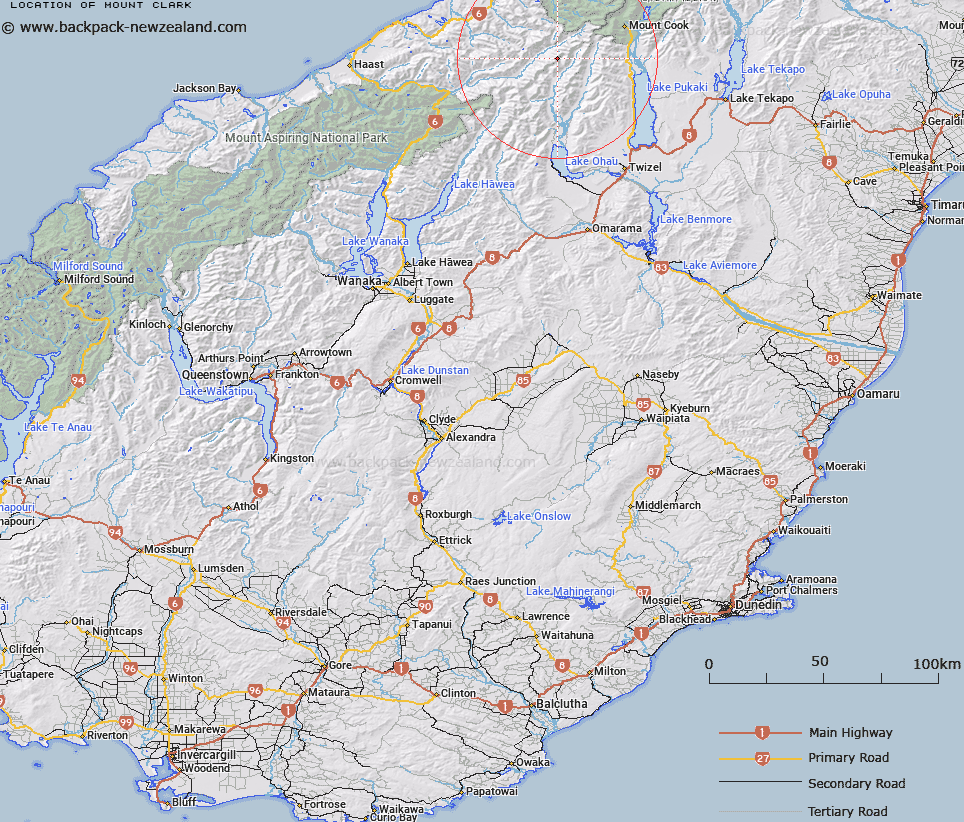
Map showing location of Mount Clark


LINZ description: Mountain at height 2450m, located on the Southern Alps/Kā Tiritiri o te Moana, between the Landsborough and Hopkins Rivers
Latitude: -43.854429
Longitude: 169.83734
Northing: 5139432.2
Easting: 1345812.1
Land District: Otago, Westland
Feat Type: Hill


Scroll down to see a more detailed road map and below that a topographical map showing the location of Mount Clark. The road map has been supplied by openstreetmap and the topographical map of Mount Clark has been supplied by Land Information New Zealand (LINZ).

Yes you can use the top static map for you school/university project or personal website with a link back. Contact me for any commercial use.

Mount Clark Map New Zealand


New Zealand places in our database
[ A ] [ B ] [ C ] [ D ] [ E ] [ F ] [ G ] [ H ] [ I ] [ J ] [ K ] [ L ] [ M ] [ N ] [ O ] [ P ] [ Q ] [ R ] [ S ] [ T ] [ U ] [ V ] [ W ] [ X ] [ Y ] [ Z ]


Closest 20 Hills to Mount Clark

Mount Marchant ( 0.96km )   Mount Ward ( 1.37km )   Mount Browning ( 2.05km )   Mount Dundas ( 2.2km )   Baker Peak ( 2.8km )   Mount Baker ( 3.46km )   Mount Nihokohatu ( 3.46km )   Mount Williams ( 4.51km )   Mount Hickson ( 4.67km )   Mount Jackson ( 5.5km )   Mount Percy Smith ( 5.64km )   Mount Humphries ( 6.78km )   Barron Peak ( 7.31km )   Mount Reticence ( 7.73km )   Welch Peak ( 8.31km )   Mount Elliot ( 8.54km )   Mount Eliott ( 8.54km )   Mount Kitson ( 8.72km )   Armistice Peak ( 8.77km )   Hut Peak ( 8.91km )   Mount Gorden ( 9.1km )   Mount Gordon ( 9.1km )   Mount Dechen ( 9.15km )   Mount Strachan ( 9.31km )   Tekoe ( 9.31km )   Mount Sinclair ( 9.54km )   Gillies Peak ( 9.54km )   Mount Gow ( 9.73km )   Mount Dobson ( 9.88km )   Mount Arthur ( 9.96km )   Mount Glenisla ( 10.24km )   Mount Fraser ( 10.82km )   Mount McKerrow ( 11.15km )   McNulty Peak ( 11.2km )   Mount Trent ( 11.24km )   Prudence Peak ( 11.53km )   Mount Matheson ( 11.54km )   Dasler Pinnacles ( 11.72km )   Fettes Peak ( 11.81km )   Crystal Peak ( 12.02km )