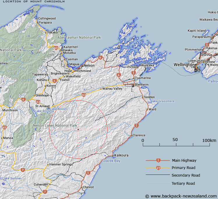
Map showing location of Mount Chrisholm


LINZ description: Mountain 2.5km north-east of Molesworth Homestead
Latitude: -42.078704
Longitude: 173.22768
Northing: 5341460.3
Easting: 1618832.7
Land District: Marlborough
Feat Type: Hill


Scroll down to see a more detailed road map and below that a topographical map showing the location of Mount Chrisholm. The road map has been supplied by openstreetmap and the topographical map of Mount Chrisholm has been supplied by Land Information New Zealand (LINZ).

Yes you can use the top static map for you school/university project or personal website with a link back. Contact me for any commercial use.

Mount Chrisholm Map New Zealand


New Zealand places in our database
[ A ] [ B ] [ C ] [ D ] [ E ] [ F ] [ G ] [ H ] [ I ] [ J ] [ K ] [ L ] [ M ] [ N ] [ O ] [ P ] [ Q ] [ R ] [ S ] [ T ] [ U ] [ V ] [ W ] [ X ] [ Y ] [ Z ]


Closest 20 Hills to Mount Chrisholm

Turks Head ( 10.5km )   Mount Muller ( 11.81km )   Barefell ( 12.27km )   Saxton ( 13.27km )   Severn ( 13.3km )   Mount Augarde ( 13.85km )   Little Benledi ( 16.14km )   Beattie ( 16.46km )   Shingle Peak ( 16.59km )   Mount Jackson ( 16.71km )   Saint Bernard ( 17.76km )   Boundary ( 19.35km )   Pudding Hill ( 19.65km )   Pudding ( 19.66km )   The Observatory ( 20.11km )   Blue Mountain ( 20.4km )   The Clock Face ( 20.98km )   Pinnacle ( 21.04km )   Dillon Cone ( 21.5km )   Carters Knob ( 21.62km )   Palmer ( 21.69km )   Mount Major ( 21.8km )   Alma Heights ( 22.02km )   Alma Peak ( 22.49km )   Red Hill ( 22.78km )   Mount Lookout ( 22.89km )   Elder ( 23.23km )   Red Hill ( 23.84km )   Mustering Hill ( 24km )   Mount Morris ( 24.51km )   The Caves ( 24.57km )   One Tree ( 25.44km )   Warder ( 25.78km )   The Beacon ( 25.92km )   Constitution Hill ( 26.21km )   Mount Union ( 26.37km )   Mount Cold ( 26.39km )   Camp Hill ( 26.93km )   Mount Costello ( 27.14km )   Stockyard Face ( 27.15km )