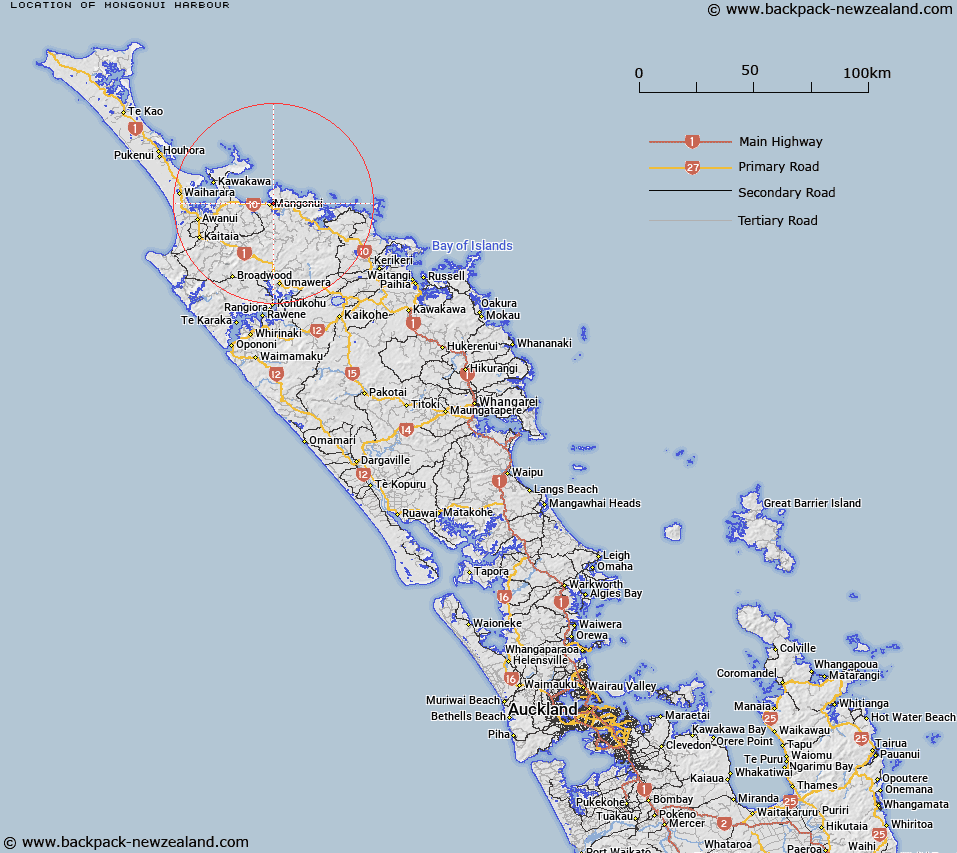
Map showing location of Mongonui Harbour


LINZ description: Harbour in south end of Doubtless Bay east of Coopers Beach.
Latitude: -34.988447
Longitude: 173.550047
Northing: 6128100
Easting: 1650200
Land District: North Auckland
Feat Type: Bay


Scroll down to see a more detailed road map and below that a topographical map showing the location of Mongonui Harbour. The road map has been supplied by openstreetmap and the topographical map of Mongonui Harbour has been supplied by Land Information New Zealand (LINZ).

Yes you can use the top static map for you school/university project or personal website with a link back. Contact me for any commercial use.

Mongonui Harbour Map New Zealand


New Zealand places in our database
[ A ] [ B ] [ C ] [ D ] [ E ] [ F ] [ G ] [ H ] [ I ] [ J ] [ K ] [ L ] [ M ] [ N ] [ O ] [ P ] [ Q ] [ R ] [ S ] [ T ] [ U ] [ V ] [ W ] [ X ] [ Y ] [ Z ]


Closest 20 Bays to Mongonui Harbour

Butler Bay ( 1.5km )   Mill Bay ( 1.94km )   Taemaro Bay ( 5.38km )   Taimaro Bay ( 5.38km )   Taimaru Bay ( 5.38km )   Te Ringa Bay ( 5.72km )   Te Reinga Bay ( 5.72km )   Cable Bay ( 5.97km )   Whangarino Bay ( 6.62km )   Okaituna Bay ( 7.03km )   Doubtless Bay ( 7.62km )   Taipa Bay ( 7.62km )   Waimahana Bay ( 7.85km )   Otengi Bay ( 9.17km )   Motukahakaha Bay ( 9.84km )   Tupou Bay ( 11.38km )   Frear Bay ( 14.1km )   Doubtless Bay ( 14.13km )   Camp Bay ( 14.27km )   Taupo Bay (West Bay) ( 14.83km )   Waihapa Bay ( 15.47km )   Te Rere Bay ( 16.11km )   Rere Bay ( 16.11km )   Te Komanga Bay ( 16.4km )   Waitepip? Bay ( 16.64km )   Waitepipi Bay ( 16.64km )   Okura Bay ( 17.33km )   Pekapeka Bay ( 17.93km )   Waihi Bay ( 17.99km )   Waihe Bay ( 17.99km )   Whangaroa Harbour ( 18.16km )   K?hatupap? / Ranfurly Bay ( 18.51km )   Ranfurly Bay ( 18.51km )   Whangatupere Bay ( 18.59km )   Florance Bay ( 18.91km )   Parakerake Bay ( 19.22km )   Pararako Bay ( 20.09km )   Waitapu Bay ( 20.23km )   Whangaroa Bay ( 20.28km )   Tauranga Bay ( 20.6km )