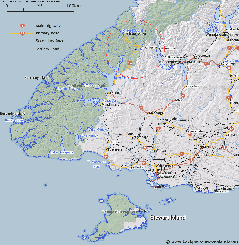
Map showing location of Melita Stream


LINZ description: Stream rising from approx 1km North-east of Consolation Peak and flowing into the middle of the western side of Lake Gunn. Greenstone Survey Survey District.
Latitude: -44.859167
Longitude: 168.06885
Northing: 5020853.6
Easting: 1210396.4
Land District: Southland
Feat Type: Stream


Scroll down to see a more detailed road map and below that a topographical map showing the location of Melita Stream. The road map has been supplied by openstreetmap and the topographical map of Melita Stream has been supplied by Land Information New Zealand (LINZ).

Yes you can use the top static map for you school/university project or personal website with a link back. Contact me for any commercial use.

Melita Stream Map New Zealand


New Zealand places in our database
[ A ] [ B ] [ C ] [ D ] [ E ] [ F ] [ G ] [ H ] [ I ] [ J ] [ K ] [ L ] [ M ] [ N ] [ O ] [ P ] [ Q ] [ R ] [ S ] [ T ] [ U ] [ V ] [ W ] [ X ] [ Y ] [ Z ]


Closest 20 Streams to Melita Stream

Falls Creek ( 2.73km )   Mistake Creek ( 3.54km )   Disappointment Creek ( 4.48km )   Duck Creek ( 5.29km )   Windfall Creek ( 5.3km )   Cascade Creek ( 6km )   McKellar Branch;Greenstone River ( 6.2km )   Plato Creek ( 6.23km )   Hut Creek ( 6.34km )   Divide Creek ( 6.4km )   Marian Creek ( 6.75km )   Pass Creek ( 7.74km )   Monkey Creek ( 7.95km )   Waterfall Creek ( 7.96km )   Caples River ( 8.58km )   Sunny Creek ( 8.98km )   Cirque Creek ( 9.54km )   Smithy Creek ( 10.85km )   Neale Burn ( 10.98km )   Glade Burn ( 11.08km )   Roaring Creek ( 11.56km )   Murcott Burn ( 11.74km )   Homers River ( 11.79km )   Fraser Creek ( 12.54km )   Eglinton River West Branch ( 12.76km )   Potters Creek ( 13.14km )   Caples Creek ( 13.35km )   Steele Creek ( 13.46km )   Clinton River ( 13.72km )   Kay Creek ( 14.35km )   Kiosk Creek ( 14.57km )   Gifford Crack ( 14.7km )   Gifford Gap ( 14.7km )   Eglinton River East Branch ( 15.26km )   Talc Creek ( 15.93km )   Cleddau River South Branch ( 15.98km )   Esperance River ( 16.01km )   Hen Burn ( 16.19km )   Clinton River North Branch ( 16.33km )   Mararoa River ( 16.45km )