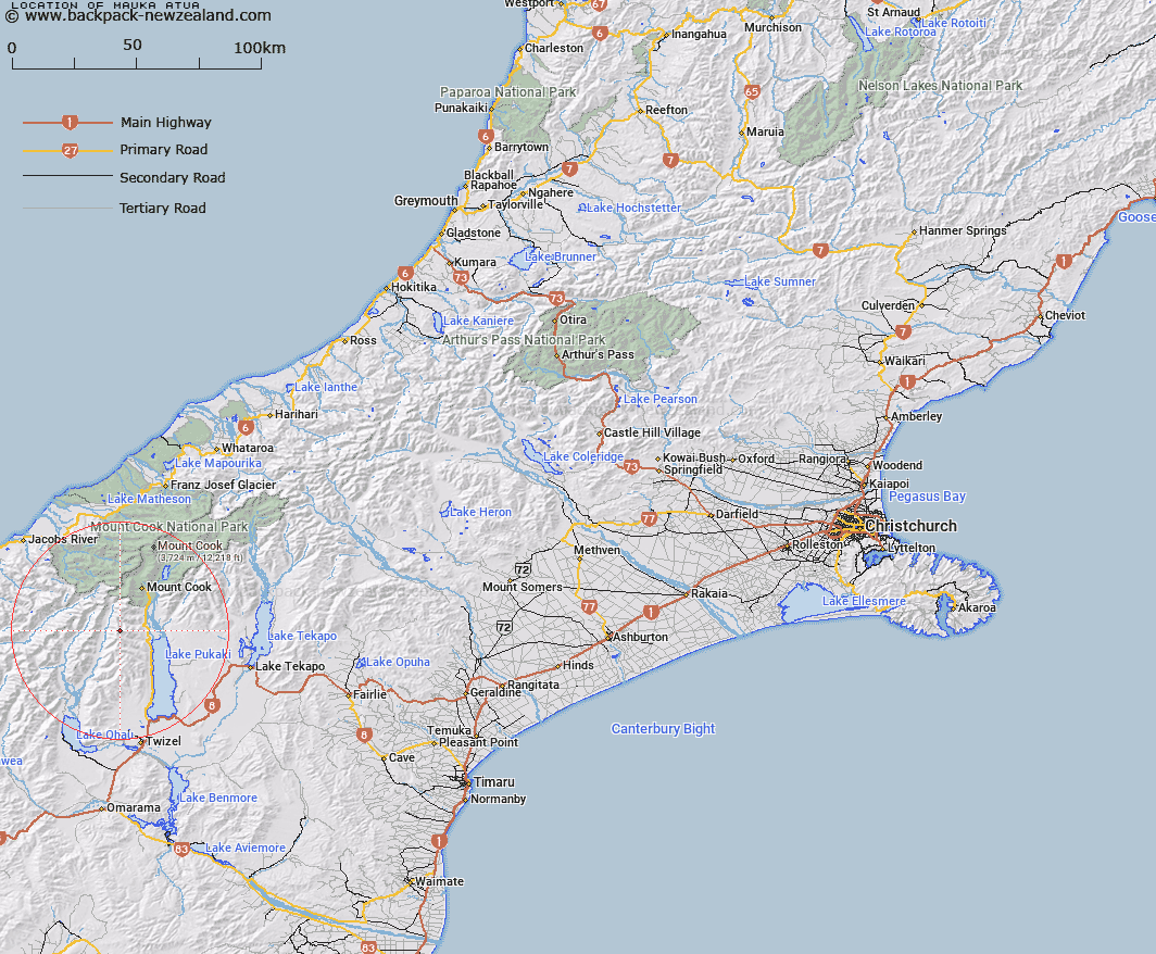
Map showing location of Mauka Atua


LINZ description: Highest point on Ben Ohau Range. Long narrow summit ridge, east of Glentanner Station.
Latitude: -43.878704
Longitude: 170.024257
Northing: 5137294.1
Easting: 1360932.6
Land District: Canterbury
Feat Type: Hill


Scroll down to see a more detailed road map and below that a topographical map showing the location of Mauka Atua. The road map has been supplied by openstreetmap and the topographical map of Mauka Atua has been supplied by Land Information New Zealand (LINZ).

Yes you can use the top static map for you school/university project or personal website with a link back. Contact me for any commercial use.

Mauka Atua Map New Zealand


New Zealand places in our database
[ A ] [ B ] [ C ] [ D ] [ E ] [ F ] [ G ] [ H ] [ I ] [ J ] [ K ] [ L ] [ M ] [ N ] [ O ] [ P ] [ Q ] [ R ] [ S ] [ T ] [ U ] [ V ] [ W ] [ X ] [ Y ] [ Z ]


Closest 20 Hills to Mauka Atua

Kai Tarau ( 0.33km )   Mount Dark ( 1.76km )   Glentanner Peak ( 3.26km )   Ferintosh Peak ( 3.59km )   Mount Brown ( 4.27km )   Round Hill ( 6.59km )   Dun Fiunary ( 7.42km )   Mount Reticence ( 7.6km )   Mount Lloyd ( 8.34km )   Mount Cran ( 8.64km )   Prudence Peak ( 9.19km )   Rocky Knob ( 9.44km )   Armistice Peak ( 9.67km )   Mount Hopkins ( 10.9km )   Kaimakamaka Peaks ( 11.12km )   Black Tower Peak ( 11.31km )   Mount Hodgkinson ( 11.33km )   Mount Sinclair ( 11.43km )   Mount Arthur ( 11.53km )   Mount Edgar Thomson ( 11.67km )   Mount McKerrow ( 11.91km )   Mount Williams ( 11.94km )   Mount Percy Smith ( 12.21km )   Mount Marie ( 12.36km )   Mount Humphries ( 12.37km )   Mount Foster ( 12.37km )   Mount Jeanette ( 12.41km )   Mount Jean ( 12.43km )   Mount Sealy ( 12.77km )   Mount Glenisla ( 12.8km )   Mount Darby ( 12.82km )   Mount Spence ( 12.85km )   Mount Massey ( 13.18km )   Mount Nihokohatu ( 13.57km )   Mount Baker ( 13.57km )   Scissors ( 13.61km )   The Big Hill ( 13.76km )   Mount Montgomerie ( 13.96km )   Mount Montgomery ( 13.96km )   Mount Browning ( 14.28km )