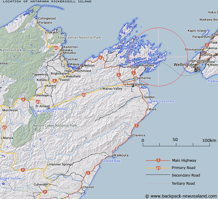
Map showing location of Matapara / Pickersgill Island


LINZ description: An island in Queen Charlotte Sound / Tōtaranui adjacent to Arapaoa Island and Blumine Island (Oruawairua). Feature shown on: NZMS260 Q27 Edition 1 1980; NZTopo50-BP29 076426.
Latitude: -41.159028
Longitude: 174.287056
Northing: 5442790.8
Easting: 1707984
Land District: Marlborough
Feat Type: Island


Scroll down to see a more detailed road map and below that a topographical map showing the location of Matapara / Pickersgill Island. The road map has been supplied by openstreetmap and the topographical map of Matapara / Pickersgill Island has been supplied by Land Information New Zealand (LINZ).

Yes you can use the top static map for you school/university project or personal website with a link back. Contact me for any commercial use.

Matapara / Pickersgill Island Map New Zealand


New Zealand places in our database
[ A ] [ B ] [ C ] [ D ] [ E ] [ F ] [ G ] [ H ] [ I ] [ J ] [ K ] [ L ] [ M ] [ N ] [ O ] [ P ] [ Q ] [ R ] [ S ] [ T ] [ U ] [ V ] [ W ] [ X ] [ Y ] [ Z ]


Closest 20 Islands to Matapara / Pickersgill Island

Blumine Island (Oruawairua) ( 4.18km )   Oruawairua Island ( 4.18km )   Blumine Island ( 4.18km )   Long Island ( 4.58km )   Arapawa Island ( 4.61km )   Arapaoa Island ( 4.61km )   Bottle Rock ( 5.23km )   Motungarara Island ( 6.01km )   Amerikiwhati Island ( 6.15km )   The Twins ( 6.66km )   Kokomohua Islands ( 6.66km )   Motuanaura Island ( 7.7km )   Motuara Island ( 7.7km )   Jordy Rocks ( 10.24km )   Moioio Island ( 11.22km )   The Brothers ( 13.58km )   Glasgow Island ( 15.19km )   Walker Rock ( 19.59km )   Allports Island ( 21.15km )   Walker Rock ( 21.89km )   Clark Island ( 22.17km )   Horahora Kakahu Island ( 23.05km )   Coombe Rocks ( 23.86km )   Mabel Island ( 25.85km )   Titi Island ( 26.25km )   Ouokaha Island ( 26.43km )   Shag Rock ( 26.83km )   Sugar Loaf ( 26.91km )   Bird Island ( 28.16km )   Forsyth Island (Te Paruparu) ( 28.52km )   The Haystack (Moturaka) ( 32.46km )   Sentinel Rock ( 33.17km )   Ninepin Rock ( 33.46km )   Oke Rock ( 33.87km )   Nukuwaiata Island ( 33.88km )   Te Kakaho Island ( 34.01km )   Chetwode Islands ( 34.02km )   White Horse Rock ( 35.1km )   Maud Island ( 36.71km )   Te Hoiere ( 36.71km )