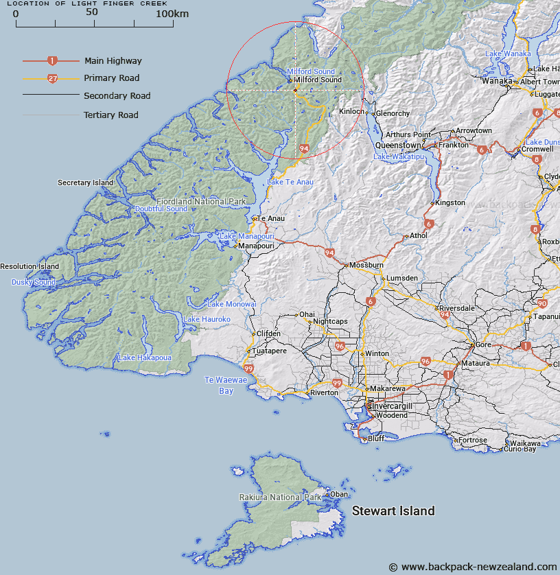
Map showing location of Light-finger Creek


LINZ description: Stream flowing into the Cleddau River. Crossed by Te Anau - Milford road, 67.9 miles from Te Anau. Flowing from the slopes of Mount Isolation.
Latitude: -44.724845
Longitude: 167.95071
Northing: 5035200
Easting: 1200133.3
Land District: Southland
Feat Type: Stream


Scroll down to see a more detailed road map and below that a topographical map showing the location of Light-finger Creek. The road map has been supplied by openstreetmap and the topographical map of Light-finger Creek has been supplied by Land Information New Zealand (LINZ).

Yes you can use the top static map for you school/university project or personal website with a link back. Contact me for any commercial use.

Light-finger Creek Map New Zealand


New Zealand places in our database
[ A ] [ B ] [ C ] [ D ] [ E ] [ F ] [ G ] [ H ] [ I ] [ J ] [ K ] [ L ] [ M ] [ N ] [ O ] [ P ] [ Q ] [ R ] [ S ] [ T ] [ U ] [ V ] [ W ] [ X ] [ Y ] [ Z ]


Closest 20 Streams to Light-finger Creek

Slip Creek ( 0.59km )   The Chasm ( 0.71km )   Cleddau River South Branch ( 1.84km )   Cleddau River North Branch ( 2.54km )   Esperance River ( 2.57km )   Cleddau River West Branch ( 2.88km )   Gulliver River ( 3.32km )   Donne River ( 4.58km )   Gifford Gap ( 5.58km )   Gifford Crack ( 5.58km )   Cleddau River ( 5.59km )   Talbot River ( 5.91km )   Homers River ( 5.93km )   Surprise Creek ( 8.14km )   Camp Oven Creek ( 8.3km )   Cirque Creek ( 8.32km )   Neale Burn ( 8.48km )   Bowen River ( 8.89km )   Monkey Creek ( 9.74km )   Joes River ( 10.23km )   Caples Creek ( 11.47km )   Leader Creek ( 11.79km )   Moraine Creek ( 11.83km )   Windfall Creek ( 12.36km )   Mackay Creek ( 12.51km )   Tutoko River ( 12.66km )   Chasm Creek ( 13.35km )   Poseidon Creek ( 13.39km )   Disappointment Creek ( 13.46km )   Epidote Cataract ( 13.6km )   Cleft Creek ( 14.12km )   Tutoko Creek ( 14.12km )   Marian Creek ( 14.18km )   Clinton River North Branch ( 14.19km )   Diamond Creek ( 14.81km )   Falls Creek ( 15.08km )   Harrison River ( 15.2km )   Swamp Creek ( 15.29km )   Pembroke Creek ( 15.36km )   Eel Creek ( 15.49km )